Derelict London - Railway Stations, Yards and Rolling Stock
London Transport - Railways
Join the mailing list (see bottom of page) to find out about Derelict London and London's Lost Rivers guided walks as soon as tickets are released plus news on my latest books and website updates. My latest book London's Lost Music Venues is out now and more information can be found at www.londonslostmusicvenues.com.
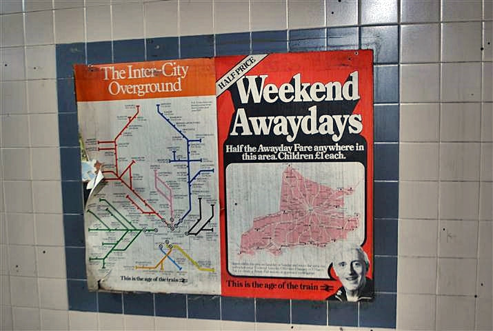
A poster from the early 1980s that remained on a disused platform at Moorgate Station for many years but was removed in 2012 following the Jimmy Saville scandal.
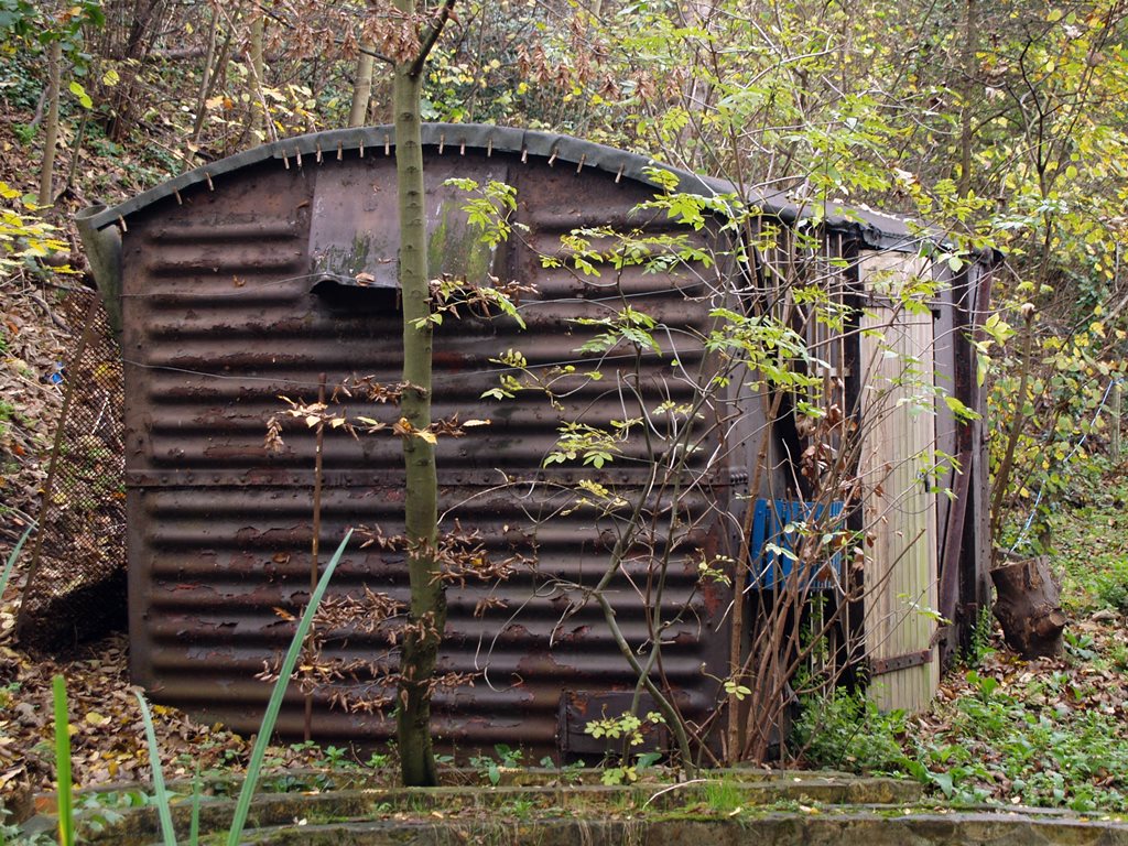
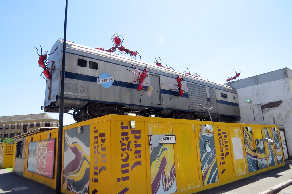
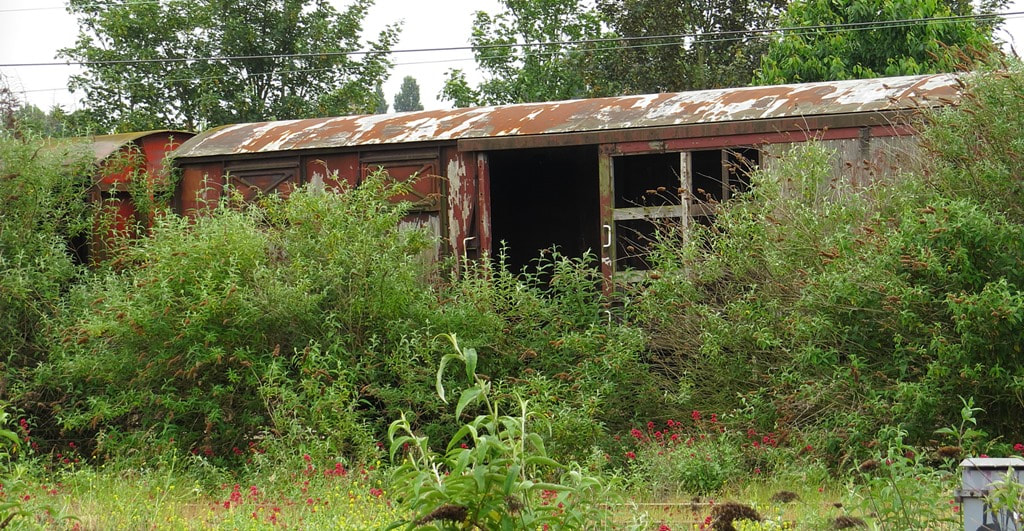
Barking, IG1 - Abandoned Railway Rolling Stock
Barking, IG1 - Abandoned Railway Rolling Stock (2021)
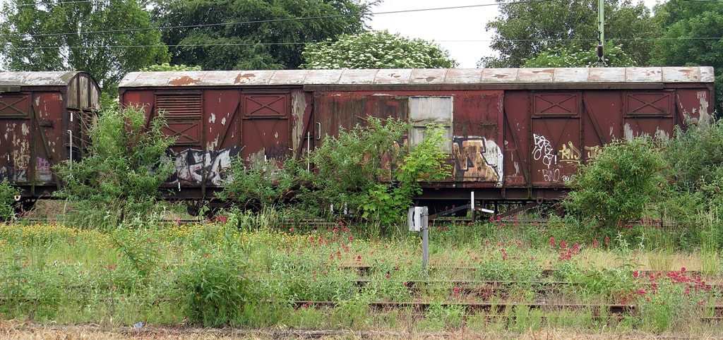
Between Barking and Dagenham Dock railway stations are these sidings with some redundant freight train wagons including some Cartic-4 wagons (car transporters). Ford launched its Dagenham Dock to Halewood (Merseyside) train using Cartic-4 wagons (up to 34 cars on each double-deck wagon) in 1966 continuing until 2013.
The Ford Motor Company at Dagenham opened in 1931 and has produced nearly 11 million cars and more than 39 million engines in its history on its 475 acre site. It once employed 40,000 staff though these days the figure is now 2,000 and the plant only assembles engines.
The Ford Motor Company at Dagenham opened in 1931 and has produced nearly 11 million cars and more than 39 million engines in its history on its 475 acre site. It once employed 40,000 staff though these days the figure is now 2,000 and the plant only assembles engines.
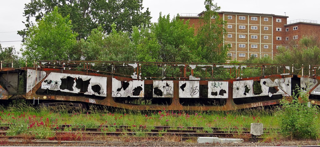
Decaying Cartic-4 wagons (car transporters) on sidings between Barking and Dagenham Dock railway stations (2021)
Barking, IG1 - Abandoned Railway Rolling Stock (2021)
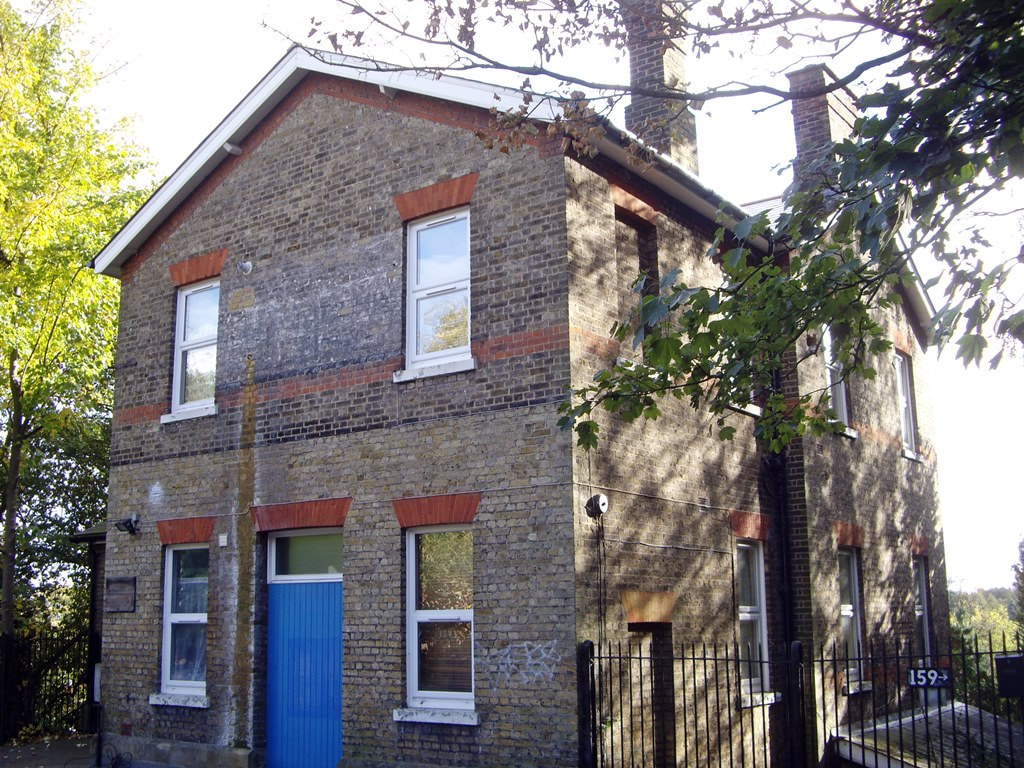
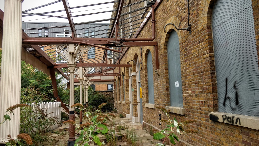
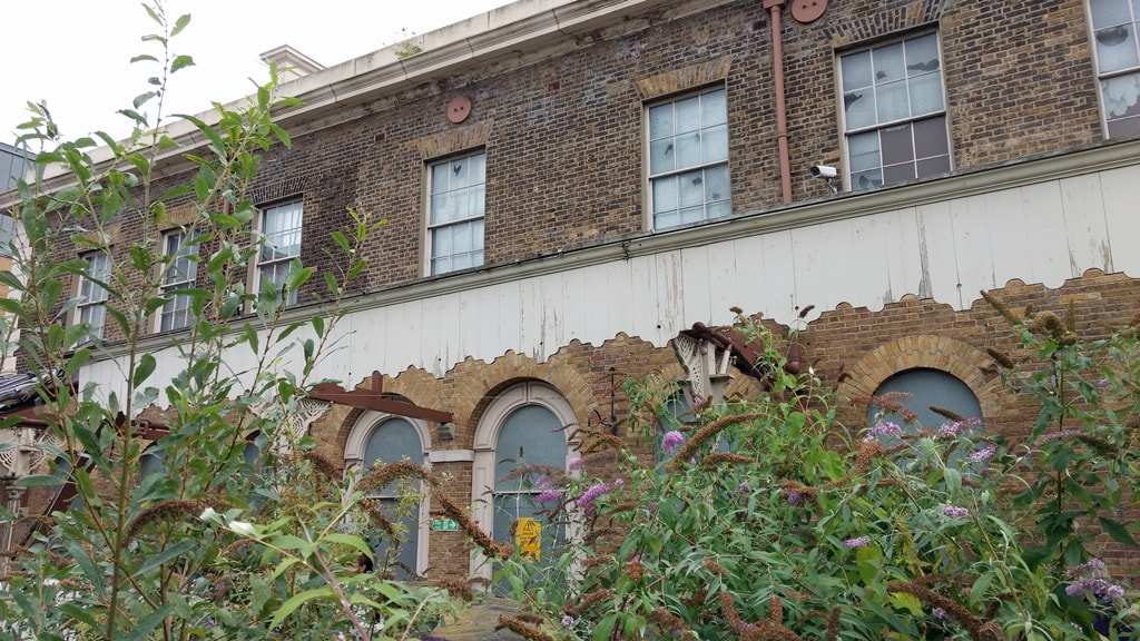
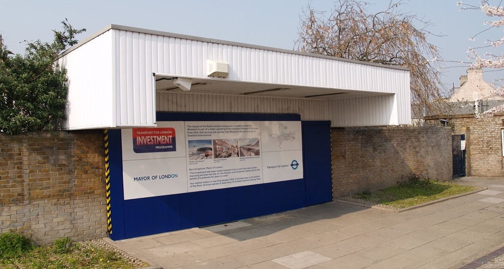
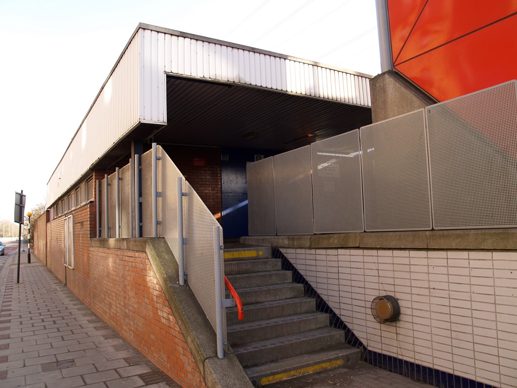
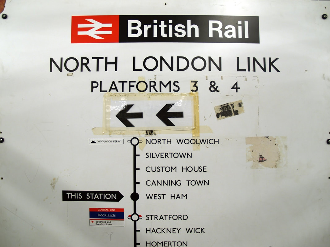
North Woolwich, E16 - Silverlink (aka North London Link)
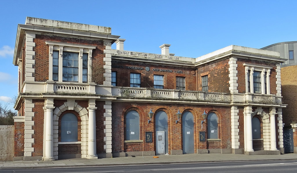
North Woolwich Station (2019)
North Woolwich station opened in 1847 as the southern terminus of the line from Stratford. The station photographed here was built in 1854.
In the 1980s the station building and a platform were closed and replaced by a minimalist white canopy entrance and passenger shelter on the south side. In 1985 the line from North Woolwich was electrified with the service running semicircular round inner north London & down to Richmond. I left my car in Richmond one night and after a night out in Ealing woke up the next morning in Canning Town and remember this long slow train journey to Richmond before picking up my car and driving to work in Hampshire....
From 1984 to 2008 the original North Woolwich station buildings and one disused platform served as the North Woolwich Old Station Museum dedicated to the history of the Great Eastern Railway. The "new" station closed in December 2006 as part of the closure of the Stratford to North Woolwich section of the Silverlink North London line. Parts of this line from North Woolwich to Custom House via Silvertown have been utilised by Crossrail with a new tunnel under the Thames near the site of North Woolwich station.
There were plans to convert the Grade II listed old Station as a public workspace for artists, local residents and creative businesses and to receive funding by the Mayor of London. Though that fell through and in 2020 the former station was advertised for sale for £1 million as a commercial building suitable for D1 use - which includes educational, medical or religious purposes.
North Woolwich Station Trackside (2016)
North Woolwich Station Trackside (2016)
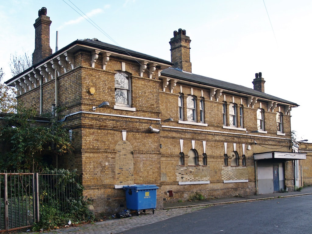
The modern North Woolwich Station (pic 2007 before it was demolished)
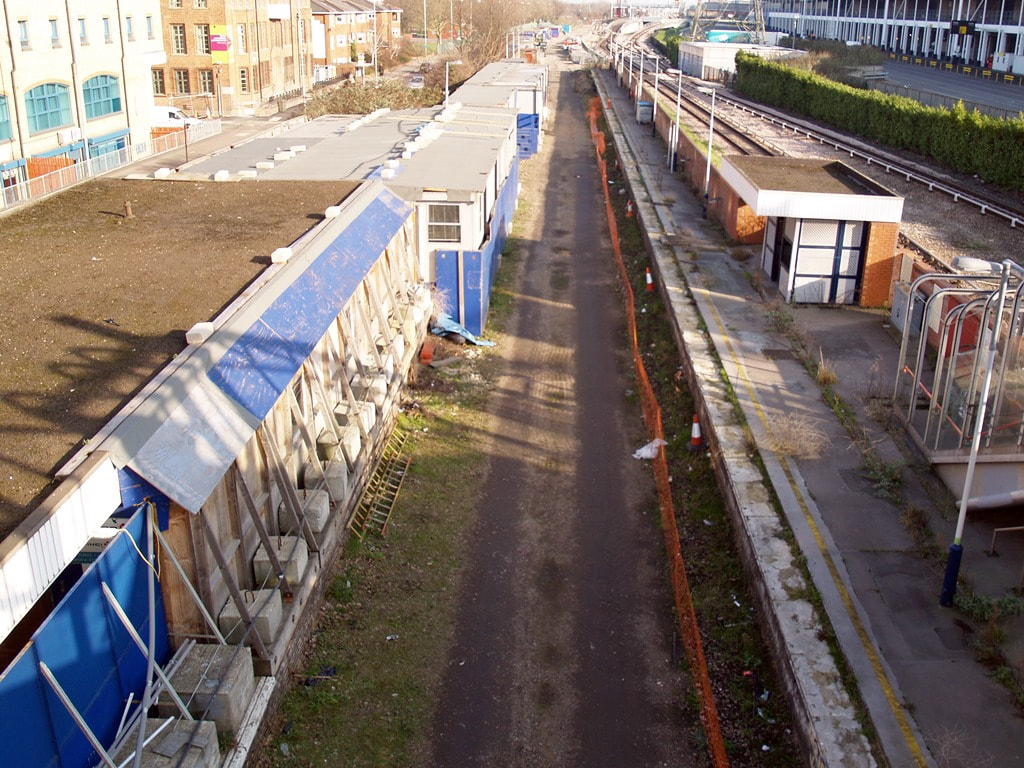
Silverlink, E16 - Silverlink (aka North London Link)
The other 2 station buildings( Silvertown & Custom House) were simple 1980s structures though situated
Parts of this line from North Woolwich to Custom House via Silvertown have been utilised by Crossrail.
Parts of this line from North Woolwich to Custom House via Silvertown have been utilised by Crossrail.
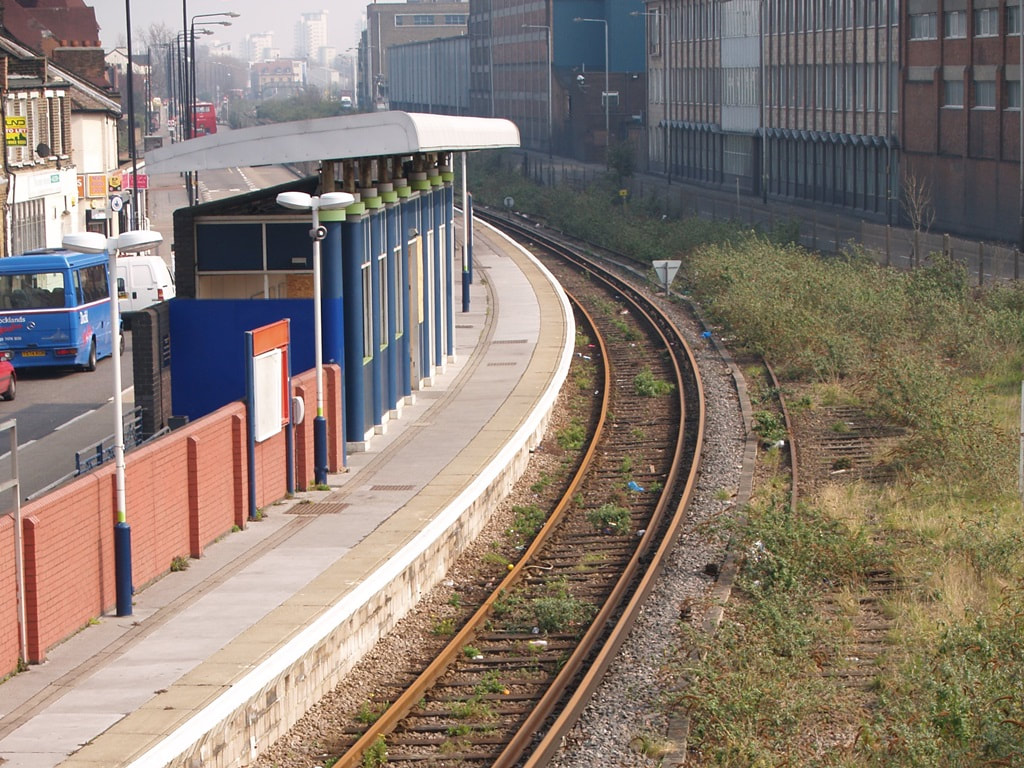
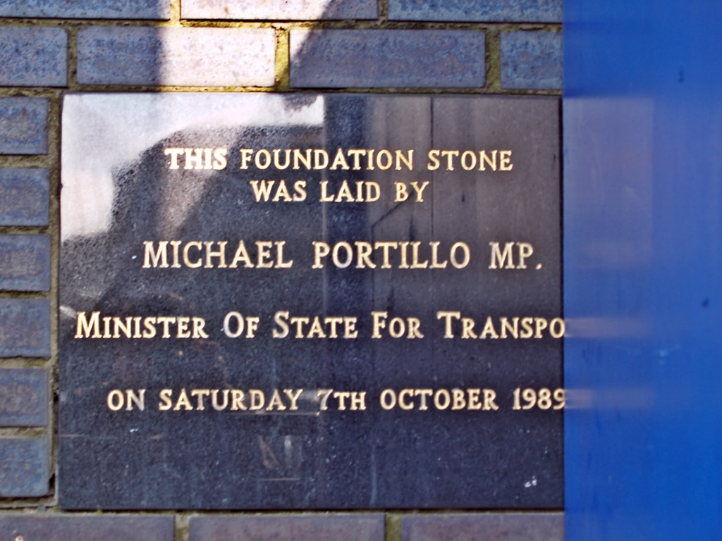
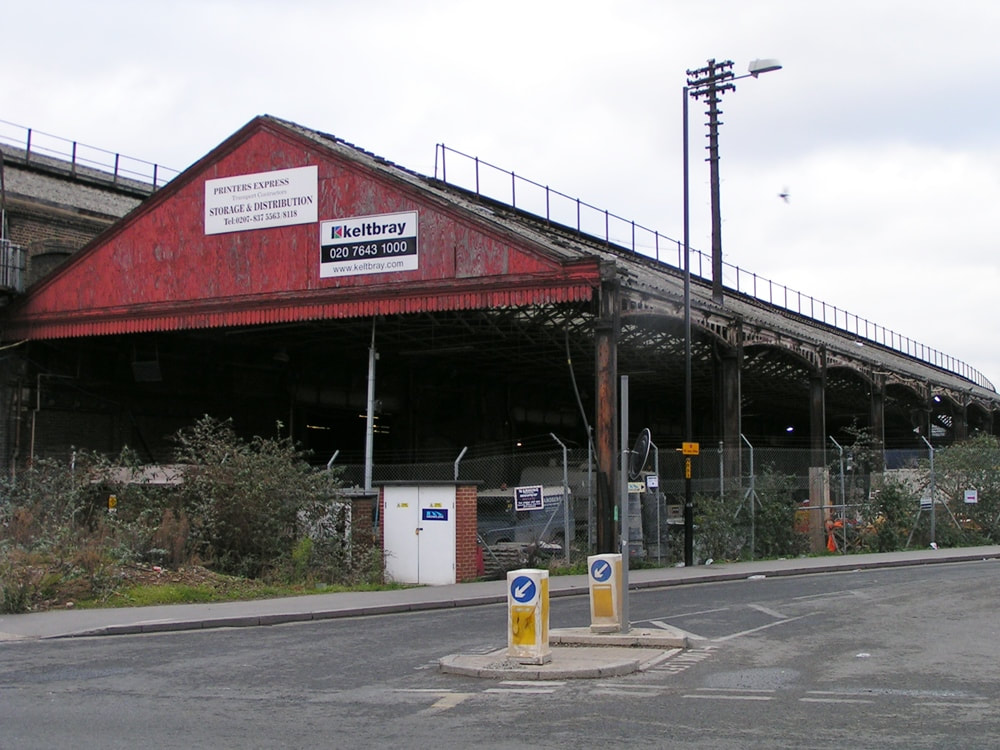
Silvertown Station (2007)
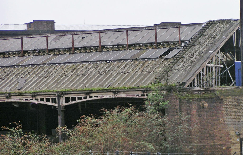
Silvertown Station was opened in 1863 in this booming area of employment with a high concentration of factories. A decline in the factories and closure of nearby docks in turn led to less use of the railway line resulting in the removal of one of the two tracks in 1980, leaving just one platform to serve trains in both directions. The old station buildings had also been demolished around that time and a basic building replaced it. After London City Airport opened nearby in 1987, another boost in passengers was not to come as the walk through adjacent side streets, and the relatively infrequent service, which was peripheral rather than into central London, led to little usage of the airport interchange. Yet another very basic new station building replaced the one built ten years previous, and this one was opened in 1989 by Michael Portillo the then Minister of State for Transport.
As with North Woolwich and Custom House Silverlink Stations this station closed in late 2006 and the building and track slipped into dereliction over the years.
The station buildings and platforms were demolished in 2012 as part of the construction of Crossrail. The Docklands Light Railway Woolwich Arsenal branch now provides a substitute service for much of this part of the old Silverlink service with the nearest DLR station to the disused Silvertown station being London City Airport.
My photographs below show Silvertown Station and its vicinity in 2011 when decay had really set in. These days it all looks very different with the Crossrail track running through it with flood protection walls either side which locals nickname the 'Berlin Wall'
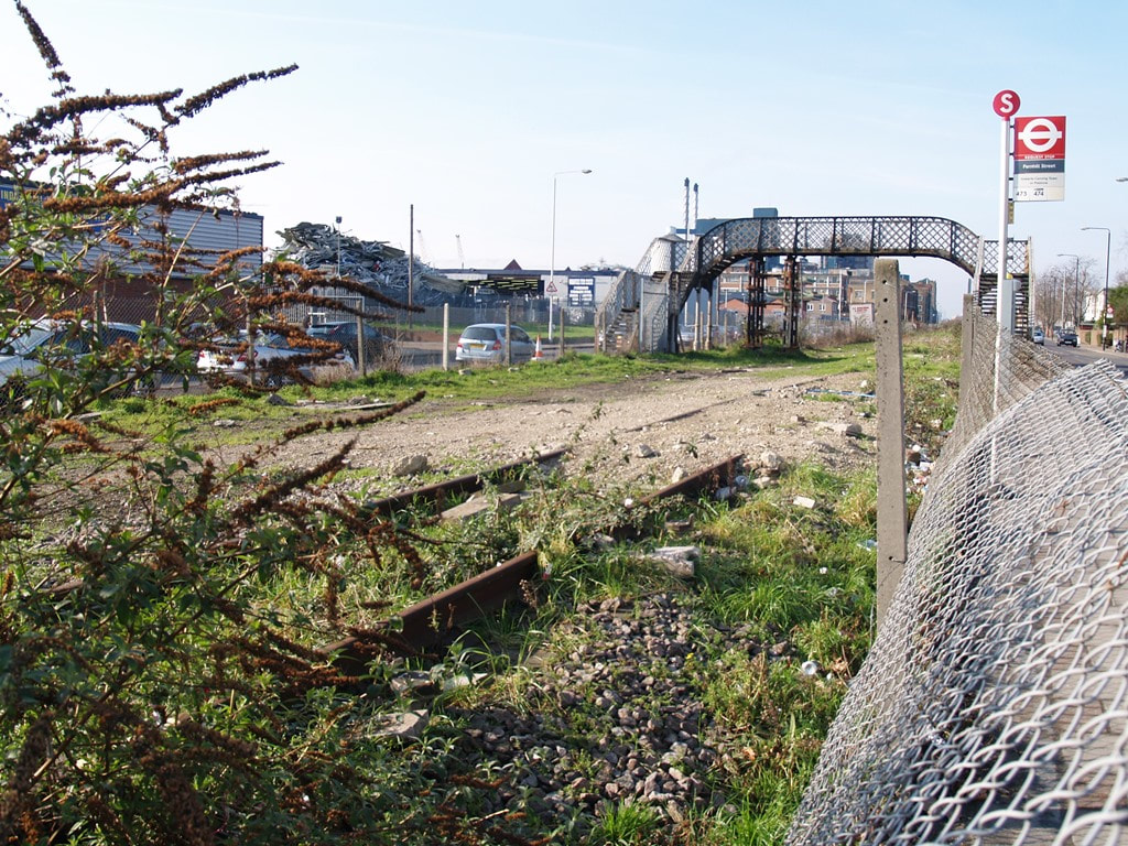
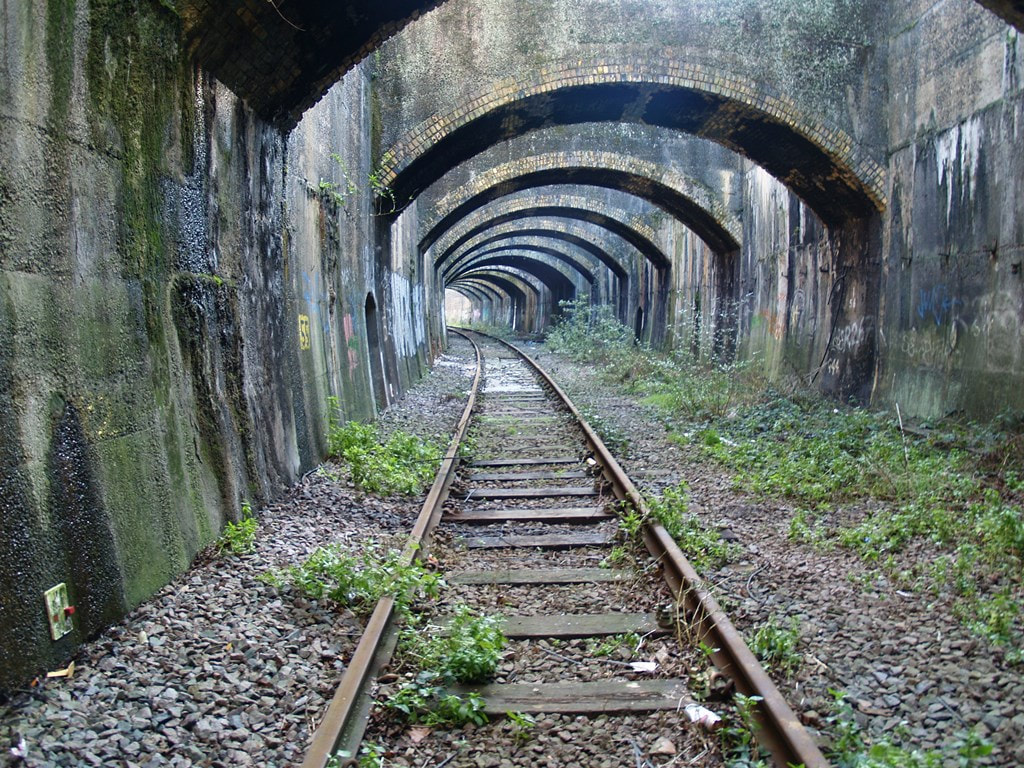
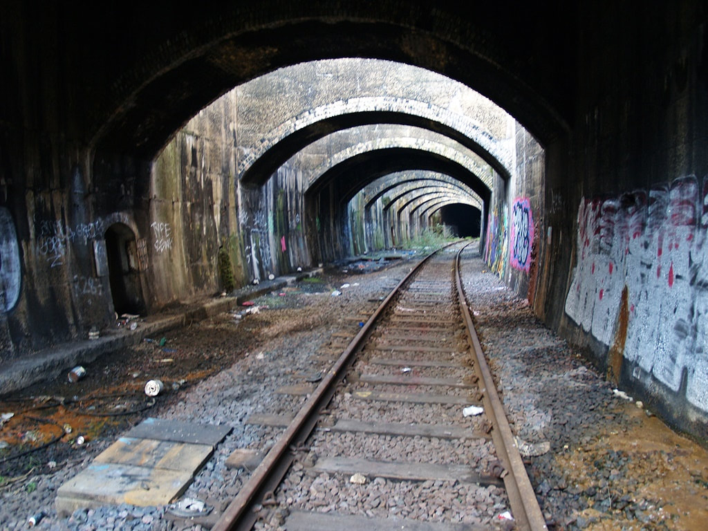
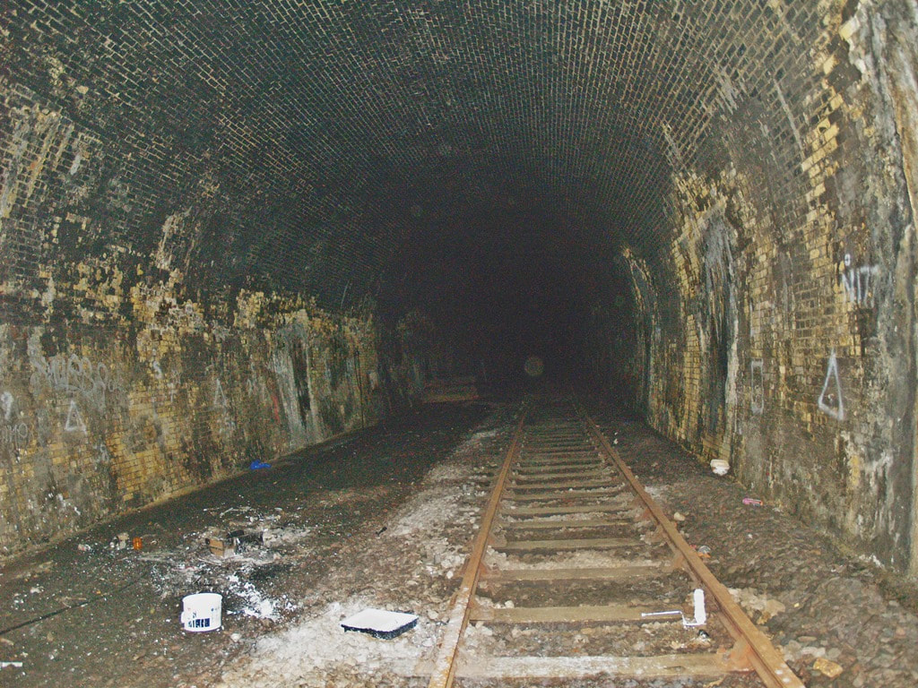
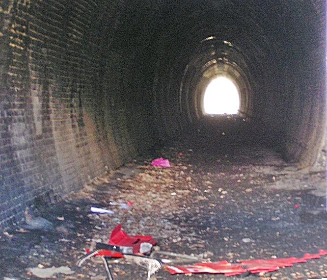
Connaught Tunnel, E16 - Silverlink North London line
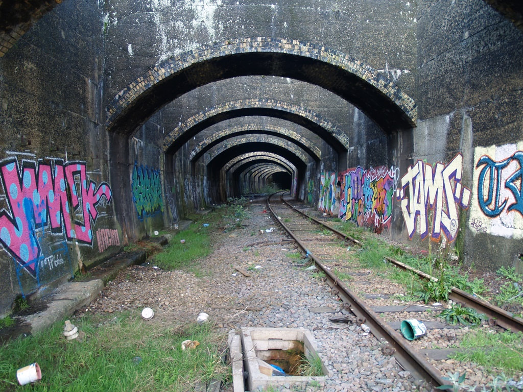
Connaught Tunnel, E16 (2011) viewed from Silvertown
On the line heading out of Silvertown towards Custom House is an interesting tunnel.
When the Royal Victoria Dock opened in 1855 the line had to have a swing bridge over the entrance to the dock, which increased journey times. In response, the line between Canning Town and North Woolwich was rerouted north of the dock through two new stations, at Custom House and Tidal Basin. Built in 1878, this 550 m cut-and-cover tunnel allowed the railway to be diverted under the Connaught passage which connected the Victoria dock and newly built Albert dock.
Crossrail is re-using the Connaught Tunnel after spending £50M on a renovation project. Crossrail says that around 100 m of tunnel wall was removed and replaced with a new tunnel lining. The existing brick arches and the tunnel approaches were retained and repaired. A large concrete base was installed on the dock floor to ensure the safety and stability of the Connaught Tunnel.
These photographs were taken in 2011 when I saw it in all its tranquil glory before the Crossrail works. Needless to say that you are forbidden to wander down here these days (Section 55 the British Transport Commission Act 1949 states a penalty for trespass on railways applies in relation to any railway, siding, tunnel, railway embankment, cutting or similar)
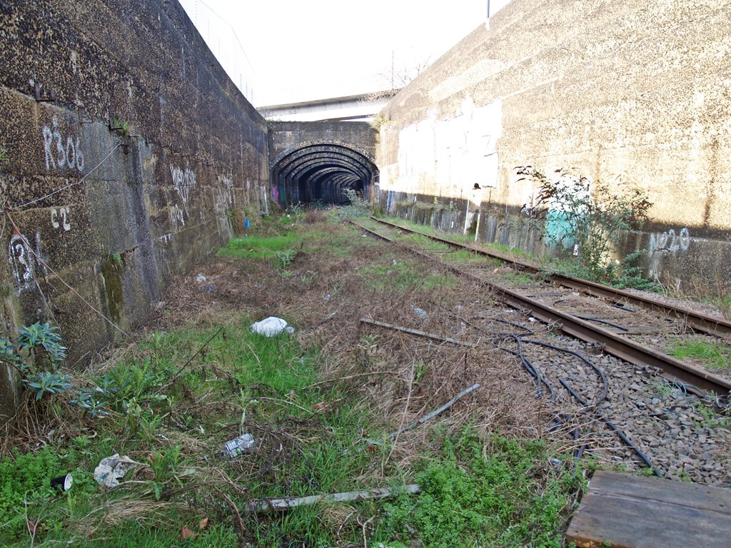
Connaught Tunnel, E16 (2011) viewed from Custom House
Custom House Station, E16 - Silverlink North London line

Custom House Silverlink Station (2011)
The main station building was demolished in 1969 and replaced by little more than a shelter. In 1995, it became an interchange station with the Docklands Light Railway before the Silverlink part closed in 2006. Photographed here in 2011 just after the line had been removed.
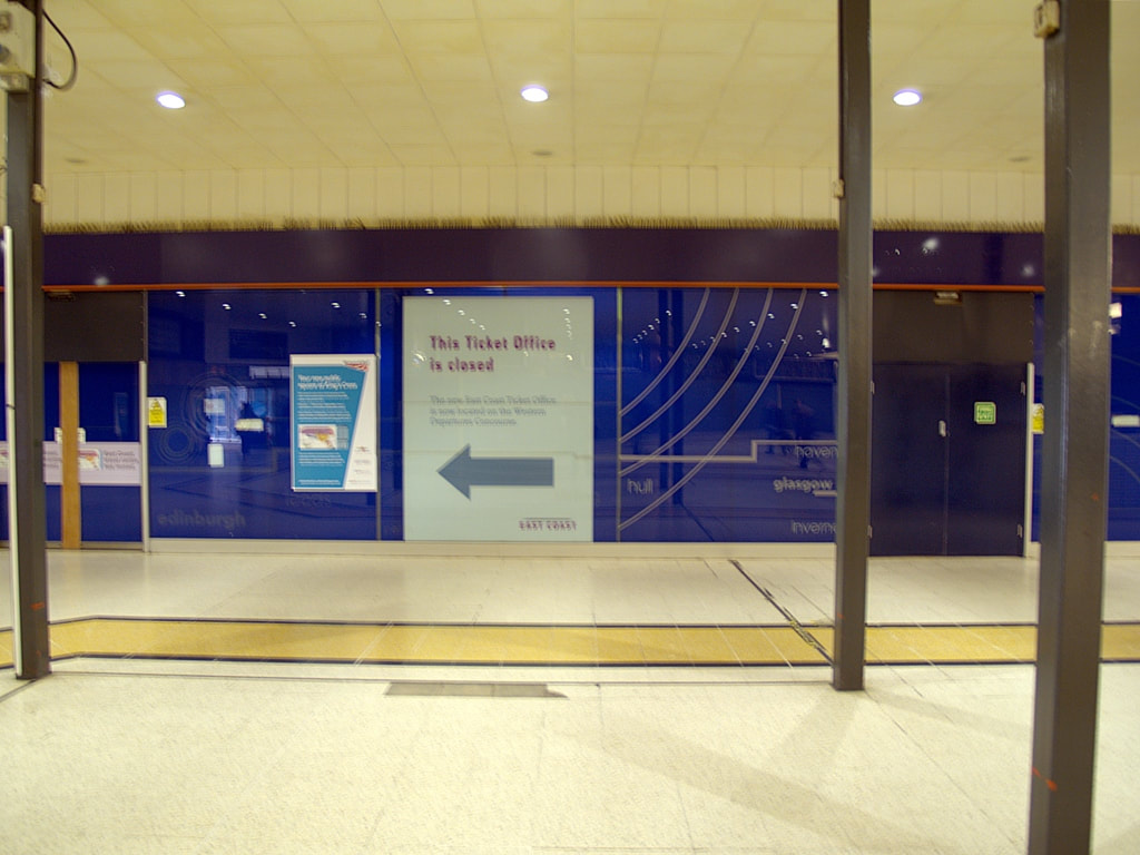
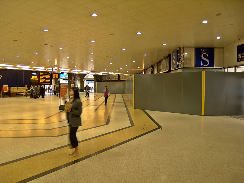
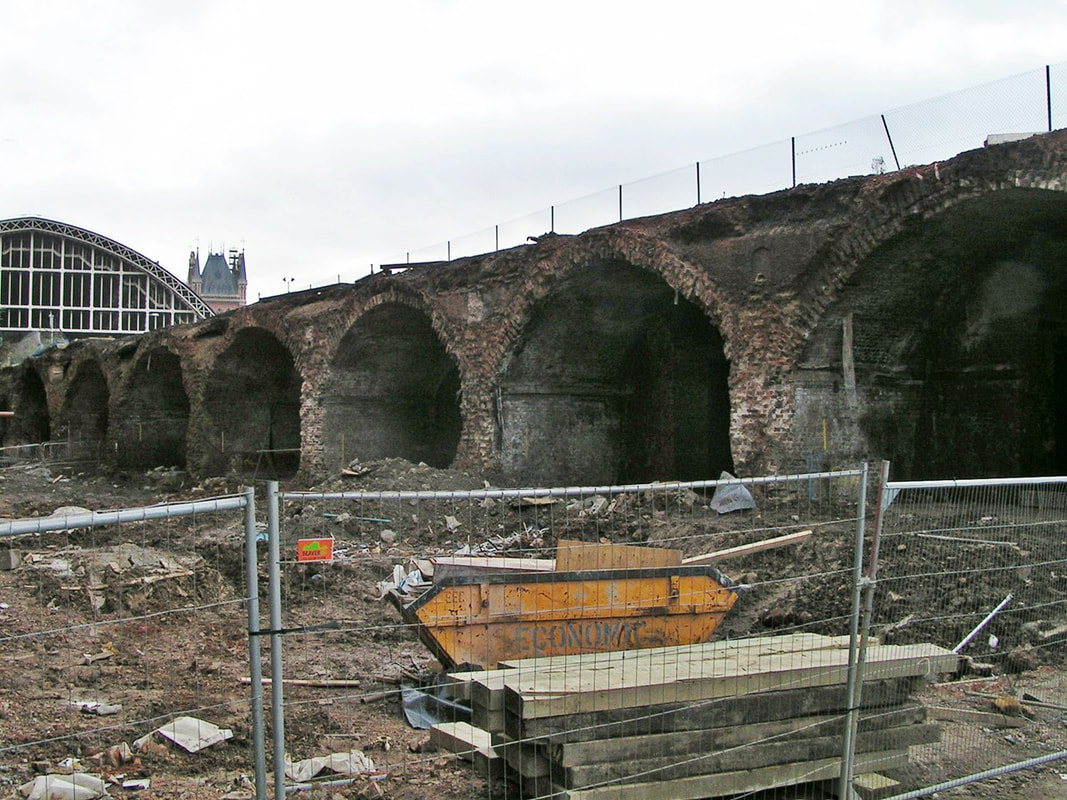
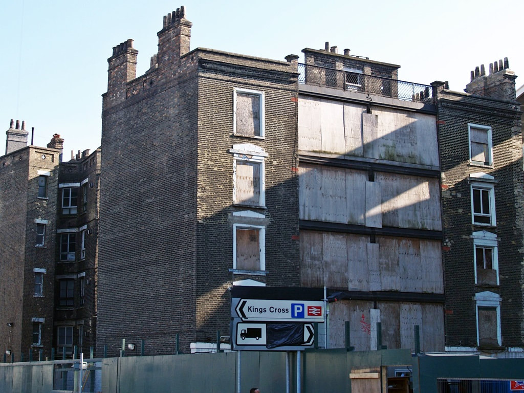
Kings Cross,N1 - Kings Cross Station

King's Cross Station 2012
The area of King's Cross was previously a village known as Battle Bridge which was an ancient crossing of the River Fleet (see www.londonslostrivers.com). The river flowed along what is now the west side of Pancras Road until it was rerouted underground in 1825. The name "Battle Bridge" is linked to tradition that this was the site of a major battle between the Romans and the British Iceni tribe led by Boudica, though this is hotly disputed by some historians.
King's Cross station, the biggest in England at the time, opened in 18552 as the London terminus of the Great Northern Railway (GNR) taking its name from a monument to King George IV that stood in the area but demolished in 1845. A single-storey extension containing the main passenger concourse, ticket office and shops, was built at the front of the station in 1972 obscuring the Grade I-listed façade of the original station. This extension was demolished in late 2012. The new layout reorients the station entrance to the side with the ticket offices, departure information and new retail and dining options placed beneath an impressive new latticed roof.
These photographs taken in 2012 of the boarded up shops & ticket hall provide a reminder of the 1970s unloved structure. A public square now occupies this space in front of the station.

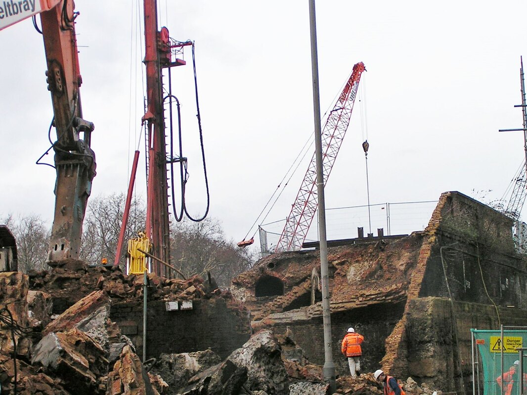
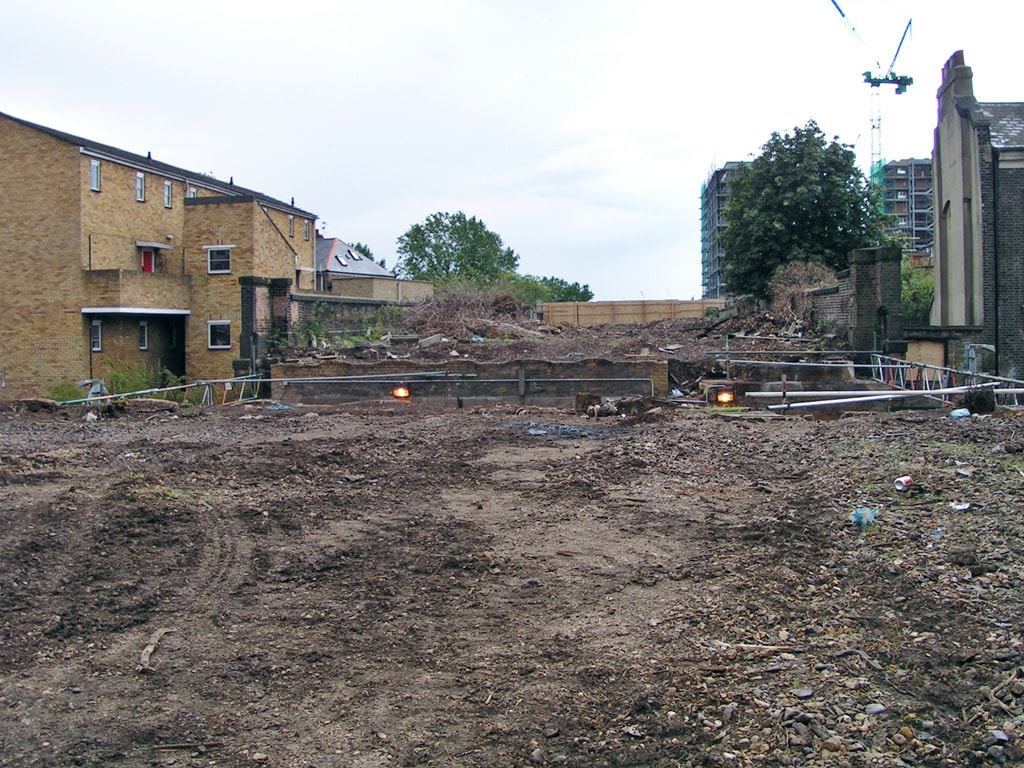
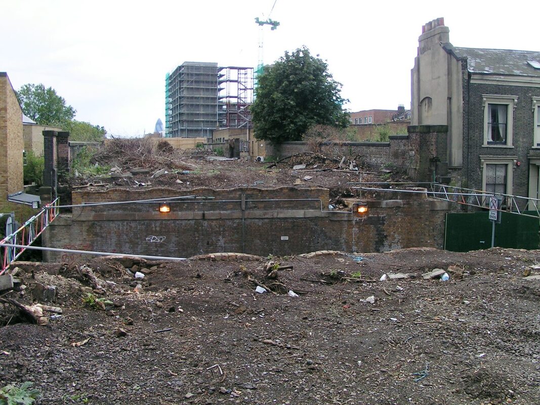
Kings Cross, N1 - Railway Lands at Rear of Station
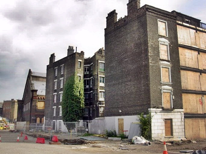
Railway lands at rear of Kings Cross Station (2003)
This area consists of approximately 67 acres of former railway lands to the north of King's Cross and St Pancras stations. Around here were coal yards, warehouses and gas works. The coal arrived by rail and was distributed around London via the adjacent Regents Canal. There were also some Victorian blocks of living accommodation for the workers. More information about these residential blocks is covered in the Derelict London book.
After World War II the area declined and became an abandoned post-industrial district and until the early 2000s it was well known for prostitution and drug abuse. Since then, King's Cross Central, a multi-billion pound mixed-use development has regenerated the site. Below is a selection of photographs that I took of the area between 2003 and 2012.
After World War II the area declined and became an abandoned post-industrial district and until the early 2000s it was well known for prostitution and drug abuse. Since then, King's Cross Central, a multi-billion pound mixed-use development has regenerated the site. Below is a selection of photographs that I took of the area between 2003 and 2012.

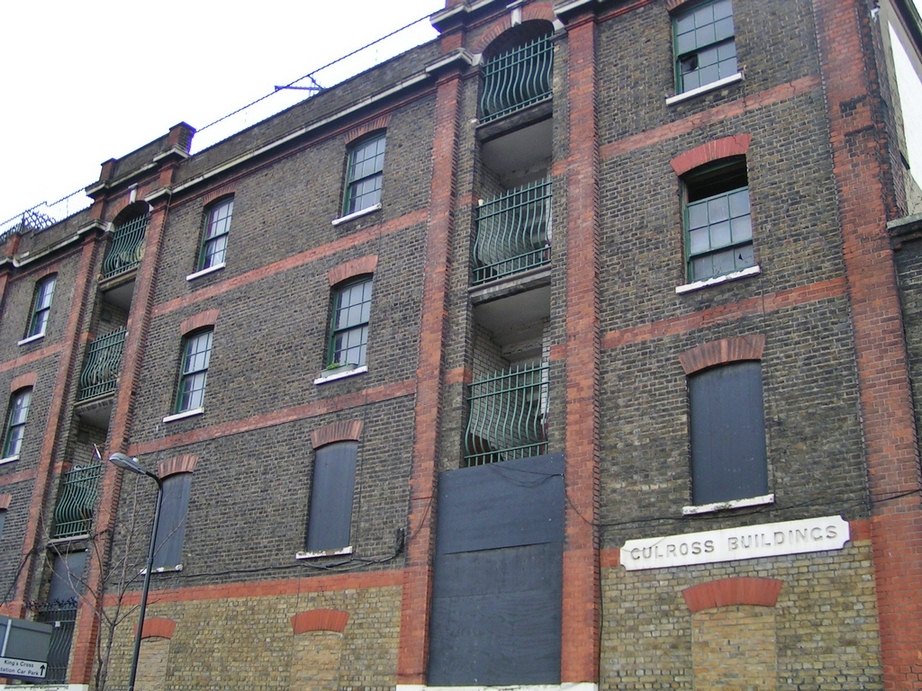


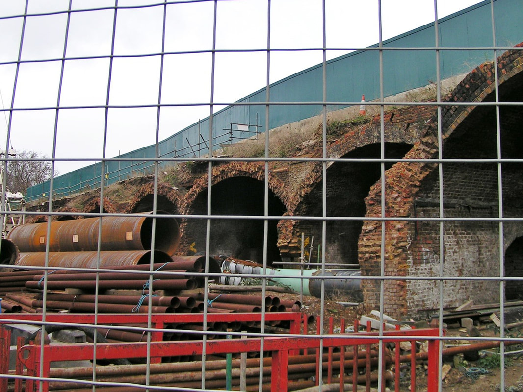

Royal Mint Street, E1 - Hydraulic Accumulator Tower
Royal Mint Street, E1 - Hydraulic Accumulator Tower (2005)
Royal Mint Street Depot (originally called Minories Depot) was opened in 1858 by the London and Blackwall Railway Company on the site on the site of the closed down Minories Railway Station. The station building situated within a viaduct was retained for the goods depot. The depot closed in 1951 and the station building is now The Minories pub. Later, Tower Gateway DLR and offices were built on the site of the rail yard.
This tower survived until 2015 when it was demolished to make way for a large residential development. The hydraulic accumulator tower held a large tank of water which was put under pressure by a weighted piston. The pressurised water was forced through pipes to provide power to operate machinery such as turntables and a lift to move wagons on and off the viaduct.
This tower survived until 2015 when it was demolished to make way for a large residential development. The hydraulic accumulator tower held a large tank of water which was put under pressure by a weighted piston. The pressurised water was forced through pipes to provide power to operate machinery such as turntables and a lift to move wagons on and off the viaduct.
Dalston, E8 - Dalston Junction Station


Dalston Junction station was first opened in 1865 on the North London line to Broad Street (a station adjacent to Liverpool Street station). The line to Broad Street and the station closed in 1986 and lay derelict until the building was demolished and the line cleared in 2005. I took these two photographs back in 2003, and they had somehow got buried in my hard drive until now.
Louise Masset was the first person to be executed in Britain in the 20th century when she was hanged at Newgate prison in January 1900 for the murder of her 3-year-old son. His battered, naked body was found, wrapped in a shawl, dumped in the women's toilet at Dalston Junction station. The child had been beaten with a brick and suffocated. In 1959, Dalston Junction was used for scenes in the film 'Look Back in Anger' starring Richard Burton. A launch party for the film was held in the station buffet.
A new station called Dalston Junction has been built on this site and opened in 2010 as part of the London Overground network. The photographs below of the stretch between Dalston Junction and Haggerston were taken in 2005 of the trackbed and bridge replacement works.
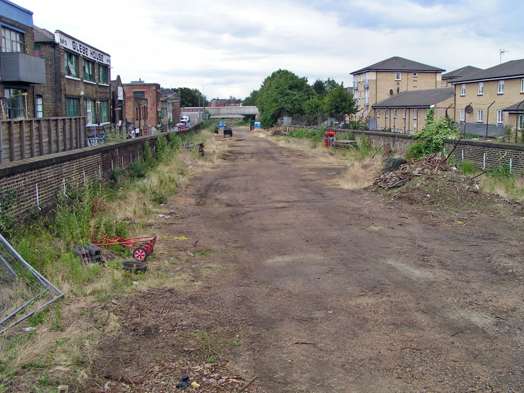
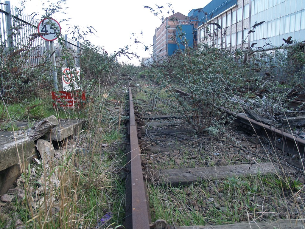
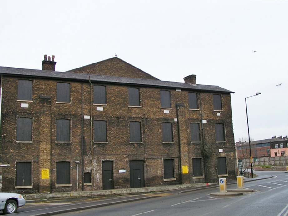
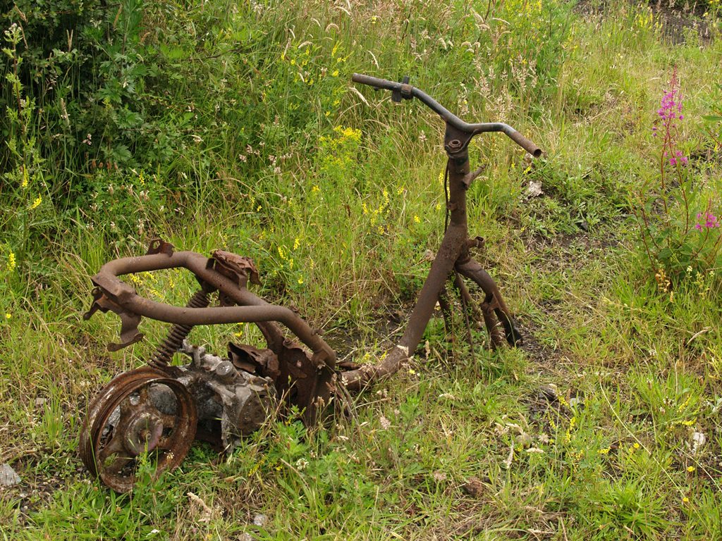
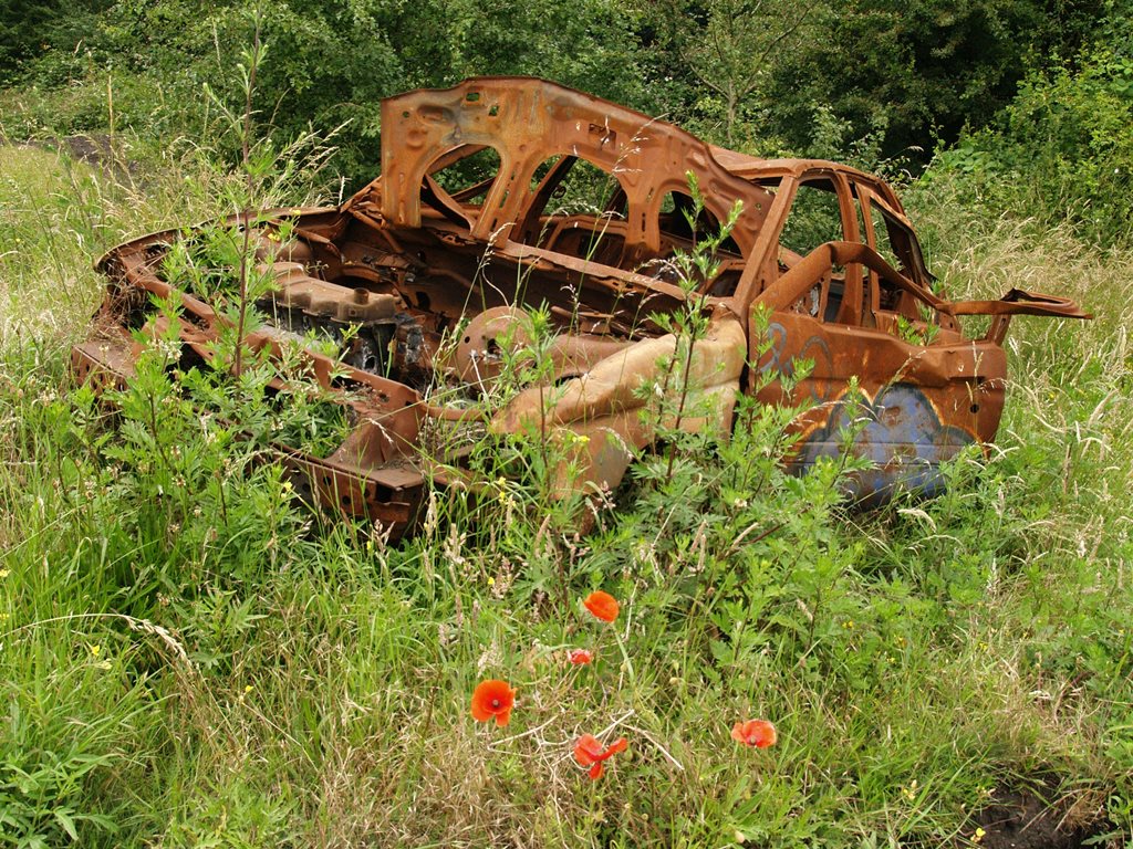
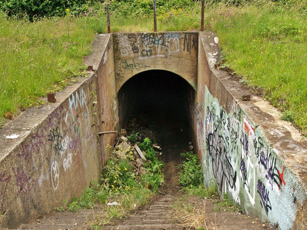
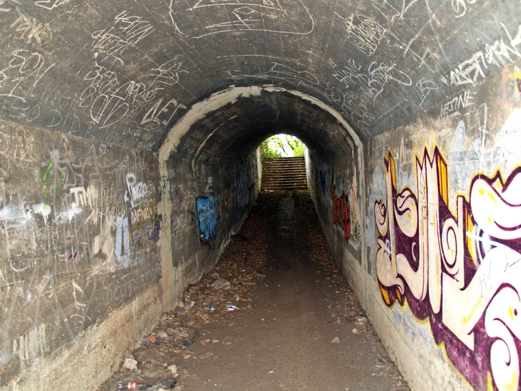
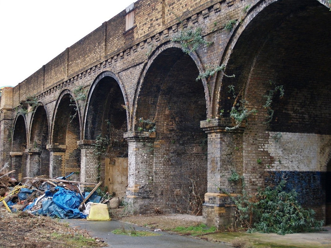
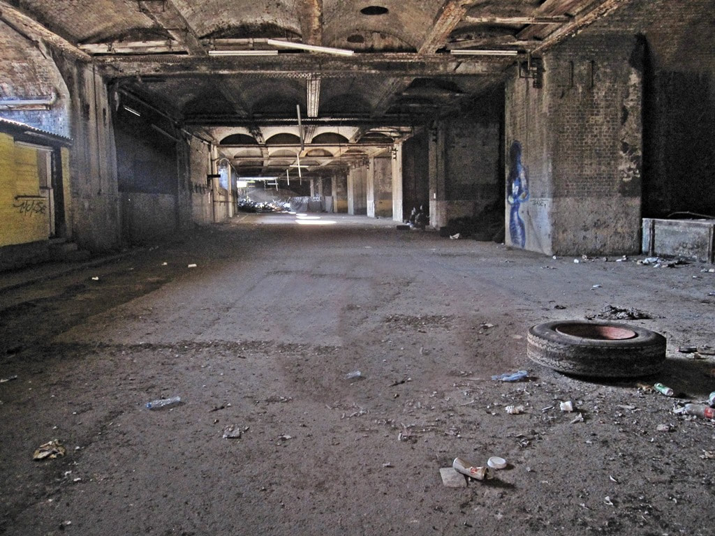
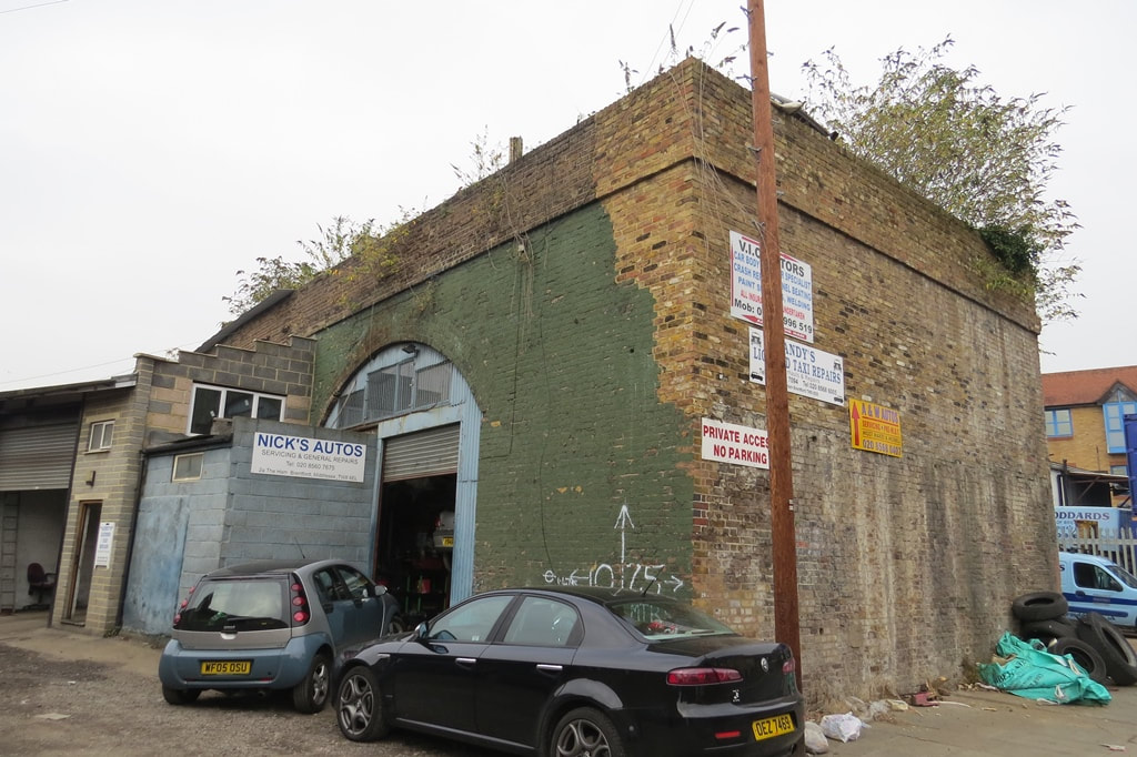
Feltham, TW13 - Rail Freight Marshalling Yard
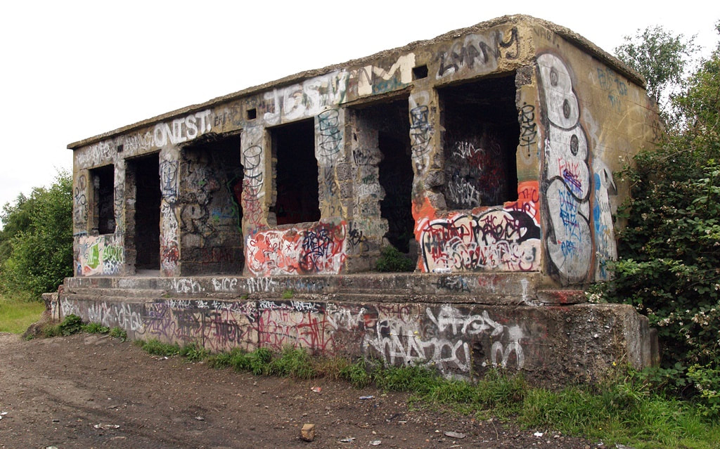
Feltham, TW13 - Rail Freight Marshalling Yard (2007)
This rail yard was built in 1918 by German prisoners-of-war. With its 32 miles of sidings it was the second-largest yard in the country, complete with repair sheds for wagons and locomotives. However, rail traffic began to decline in the 1960s, and the yard eventually closed in 1969. It was dismantled over the following decade.
When I took these photographs in 2007 when it was an overgrown and tranquil wilderness. There were a few abandoned cars burnt out by joyriders but little evidence that there was a yard here, apart from one graffiti-covered concrete building. Recent excavations on the site have revealed remains of Iron Age pottery.
Despite the depot closing decades ago the site had remained in railway ownership and in 2020 South Western Railway started construction on a new £60 million depot on this site.


Lea Bridge Road, E10 - Lea Bridge Station
Lea Bridge Road, E10 - Lea Bridge Station 2005
The station was opened in 1840 by the Northern and Eastern Railway as Lea Bridge Road and is thought to be the earliest example of a station having its building on a road bridge, with staircases down to the platforms. The original station building was an Italianate style structure and featured a bell turret on the roof with a bell that was rung when a train was due. The station building was demolished during the mid 1970s and replaced with the simple shelter photographed here in 2005. By then, a train service operated between Tottenham Hale and North Woolwich via Stratford and the withdrawal of that service led to the closure of the station in 1985.
The derelict remains of the old station have been demolished and replaced by a new station on the site costing £11 million opened in 2016. Greater Anglia Trains stop here on a service between Stratford and Bishop's Stortford and Meridian Water.
The derelict remains of the old station have been demolished and replaced by a new station on the site costing £11 million opened in 2016. Greater Anglia Trains stop here on a service between Stratford and Bishop's Stortford and Meridian Water.
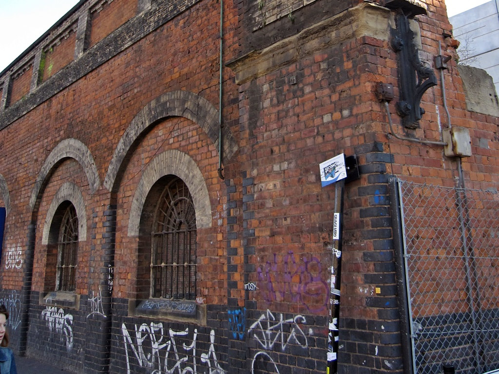
Bermondsey, SE1 - Spa Road Railway Station
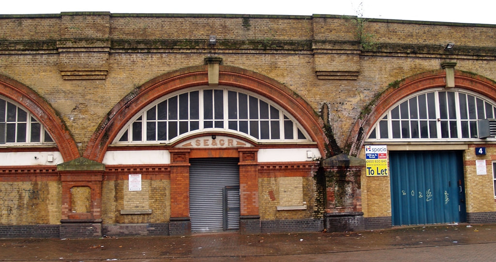
Bermondsey, SE1 - Spa Road Railway Station
Spa Road station was the terminus of London’s first railway, the London and Greenwich Railway, and, in fact, there were actually two Spa Road station sites. The first, opened in 1836, further along the viaduct. The second one, shown here, replaced it in 1867 and was renamed Spa Road and Bermondsey in 1877. When the South Eastern and Chatham Railway was formed in 1899, the station was remodelled and given the current appearance.
It was closed during the First World War due to staff shortages, and, because it had never attracted many passengers, was then never reopened.
Remains of the old platforms can still be seen from trains passing between Deptford and London Bridge. In 1999, a train from Dover to London Charing Cross collided with a train from Brighton to Bedford at Spa Road, causing both to derail. Four people were injured, and a number of passengers had to be evacuated through the old station.
The arch shown here displays the signage of the South East & Chatham Railway; some bricked-up ticket windows are also visible.
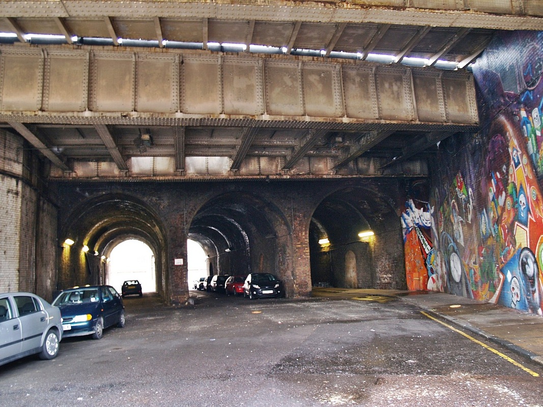
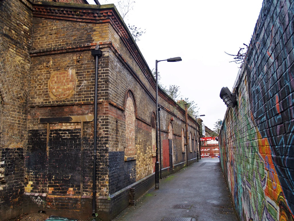
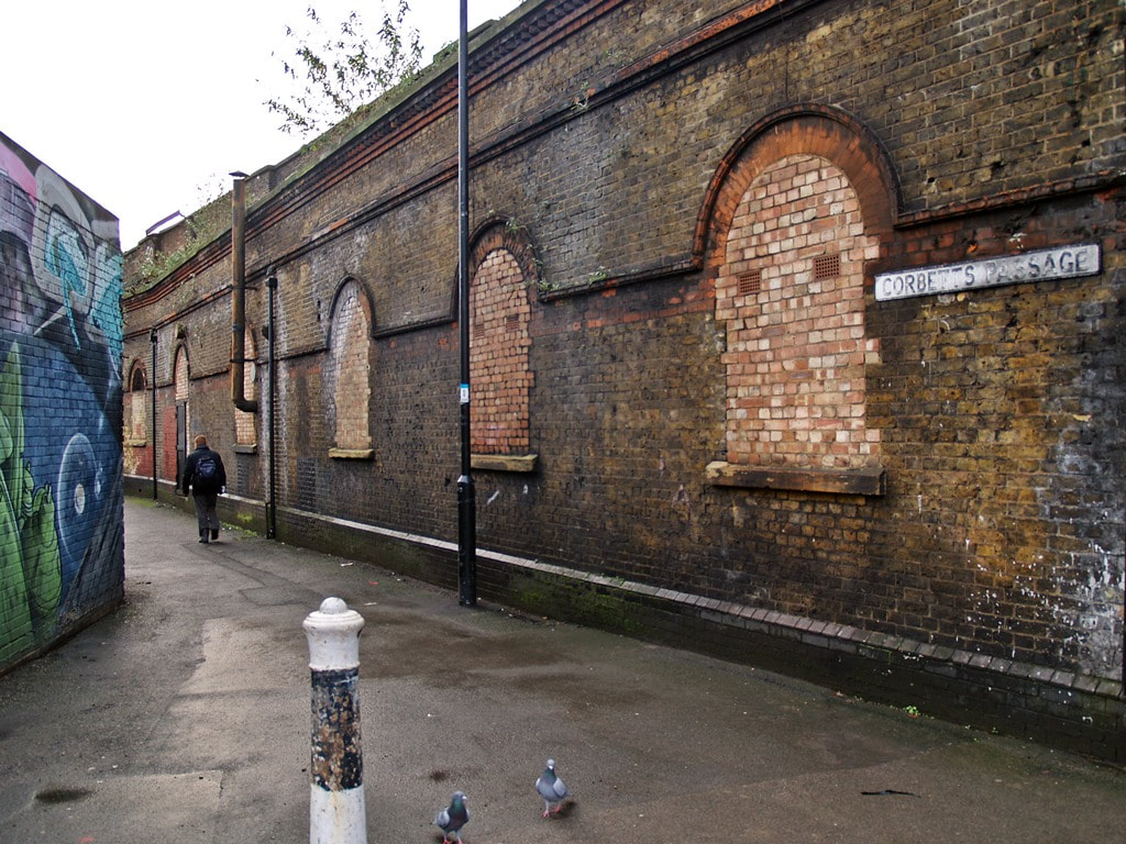
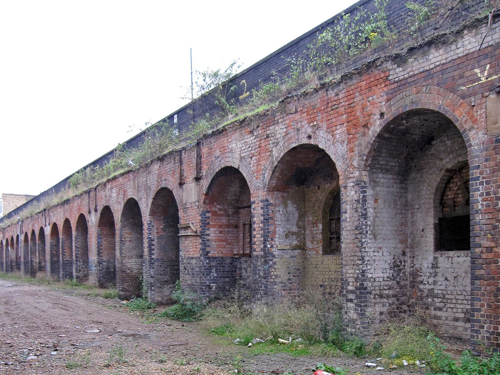
There are some 800 arches in the viaduct that extends on the stretch between London Bridge and Deptford. Between the old Spa Road Station and the disused Southwark Park Station is a stretch of this continuous viaduct built in the 1830s. Many of the arches in this stretch are derelict. The pics below were taken between 2008 and 2016.
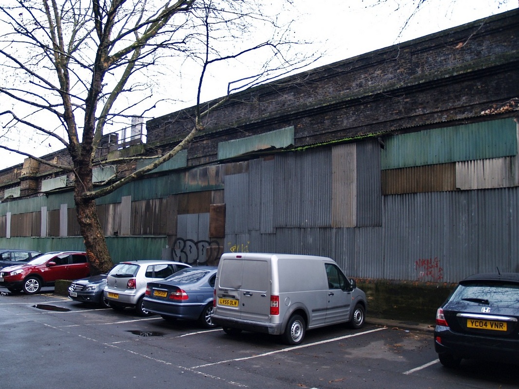
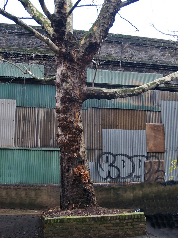
Bermondsey, SE1 - Southwark Park Railway Station
Bermondsey, SE1 - Southwark Park Railway Station
The next stop south of Spa Rd Station was Southwark Park station. It opened in 1902 and replaced the Commercial Docks station slightly to its south. It lay between Spa Road to the north-west and Deptford to the south-east.
Like Spa Road, it closed in 1915 due to wartime economies in WW1, and did not reopen due to competition from other public transport. The station building still survives although the entrances and windows are bricked up.
The abandoned interior of the ticket hall and foundations for the platforms were uncovered by Network Rail in 2015 as part of the Thameslink Programme upgrade. The station was discovered as engineers constructed the Bermondsey Dive Under, which has seen viaducts partially demolished and rebuilt to allow trains from south-east London and Kent to dive under a new route carrying Thameslink services from Croydon. They uncovered the footings for the former platforms while preparing the top of the viaduct for new track and used the roof space of the former ticket hall to fill in the old skylights.


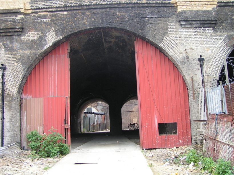
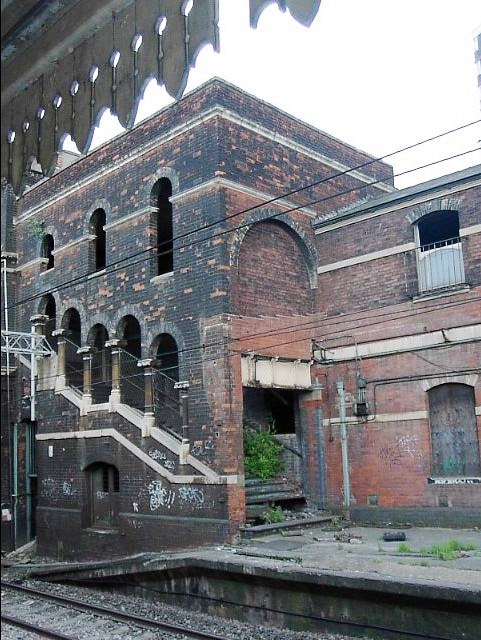
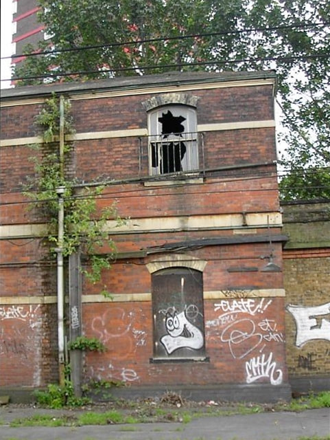
Camberwell, SE5 - Camberwell Railway Station
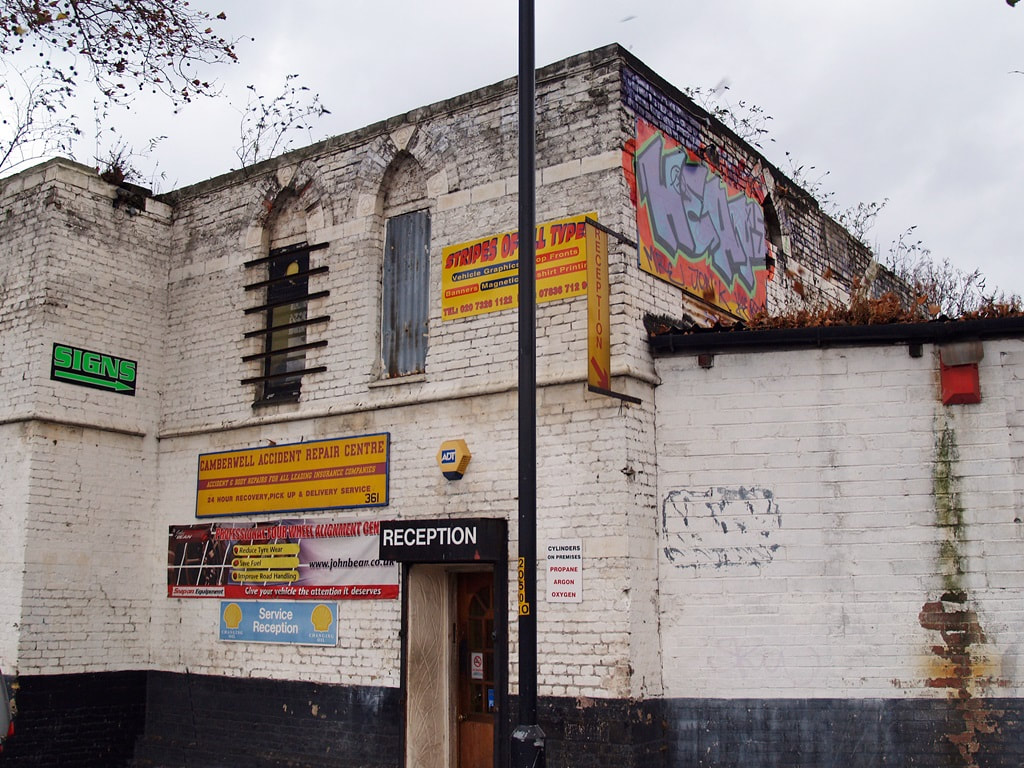
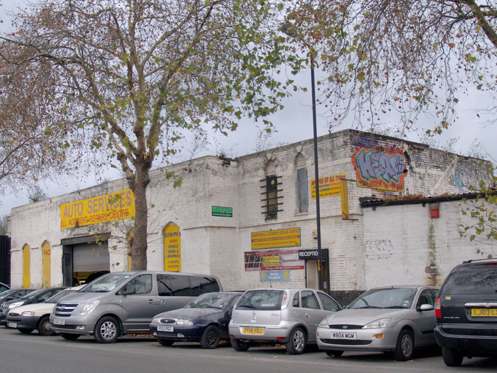
Camberwell railway station was on the London, Chatham and Dover Railway (LC&DR). It opened in 1862 though a year later the name was changed to Camberwell New Road but in 1908 reverted to Camberwell. As with many other London stations such as Spa Rd, wartime restraints forced it to close to passengers in 1916.
Today Camberwell Station Road still survives where the original station building has been converted to a garage. At track level fragments of the platforms can be seen from passing trains. Various proposals to reopen the station have been put forward in recent years.
Today Camberwell Station Road still survives where the original station building has been converted to a garage. At track level fragments of the platforms can be seen from passing trains. Various proposals to reopen the station have been put forward in recent years.
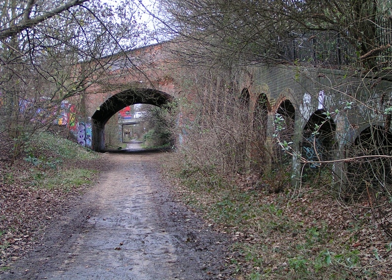
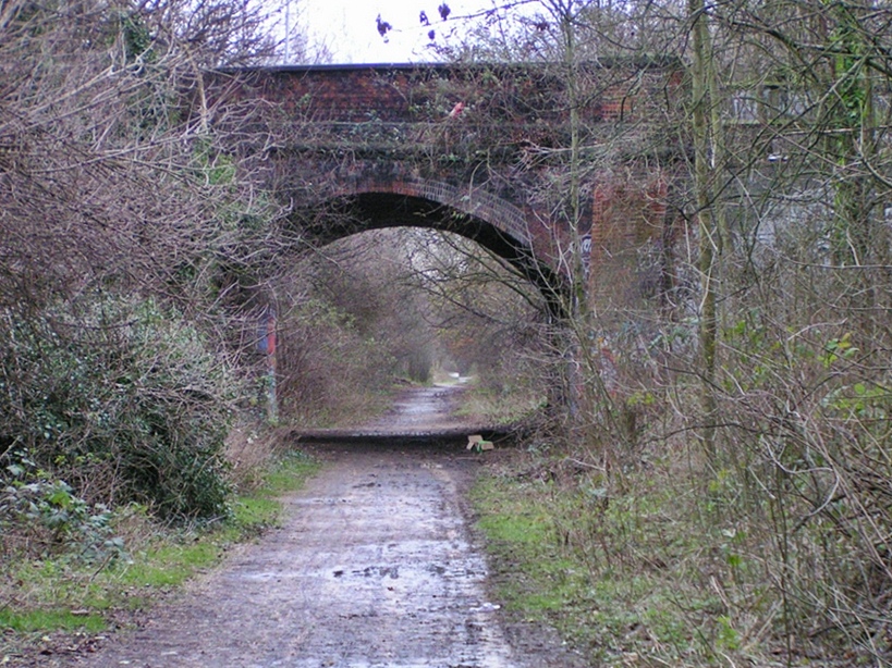
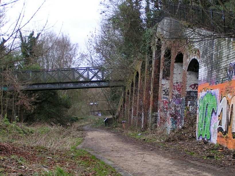
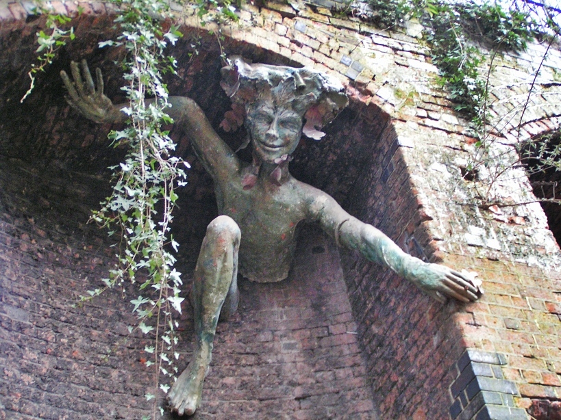
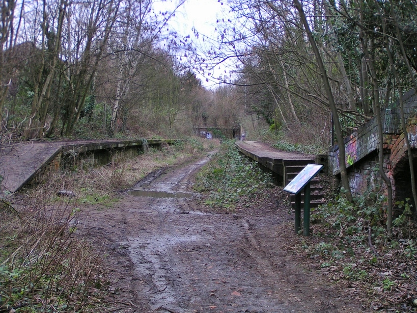
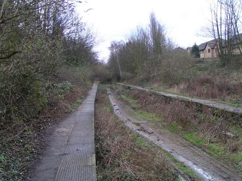
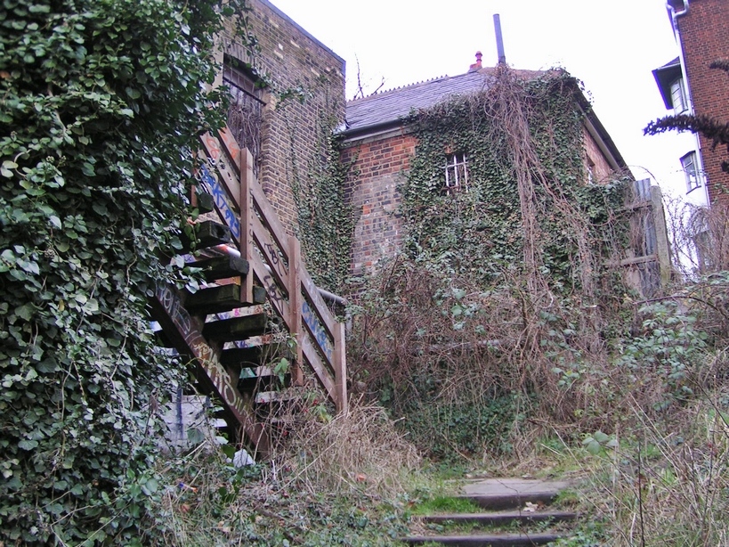
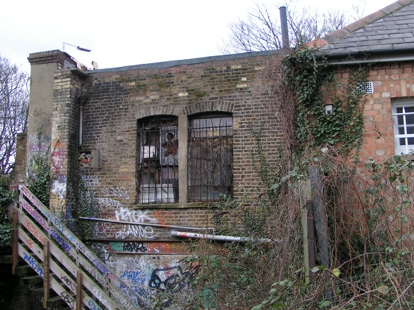
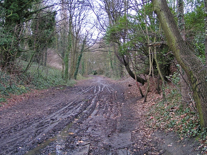
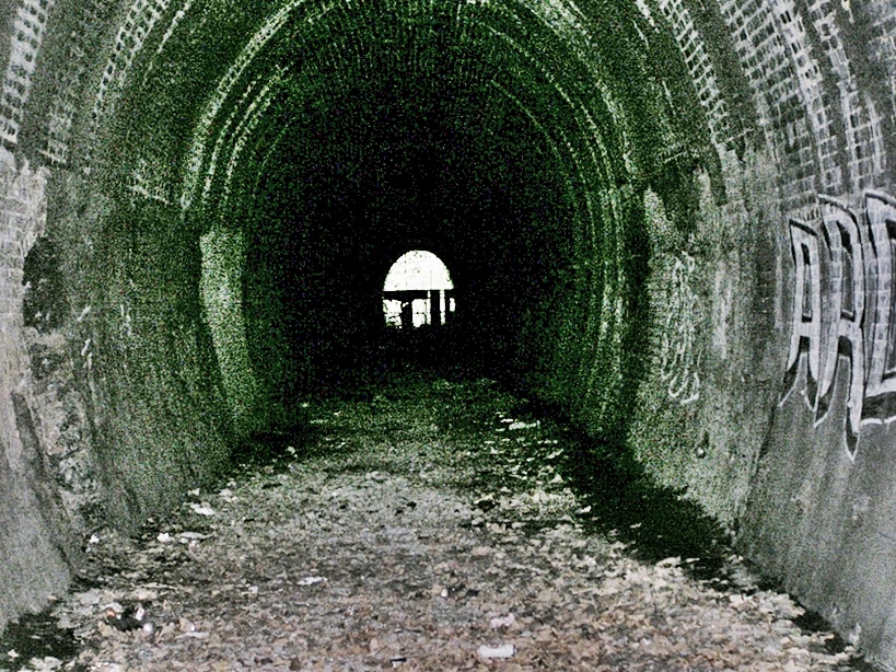
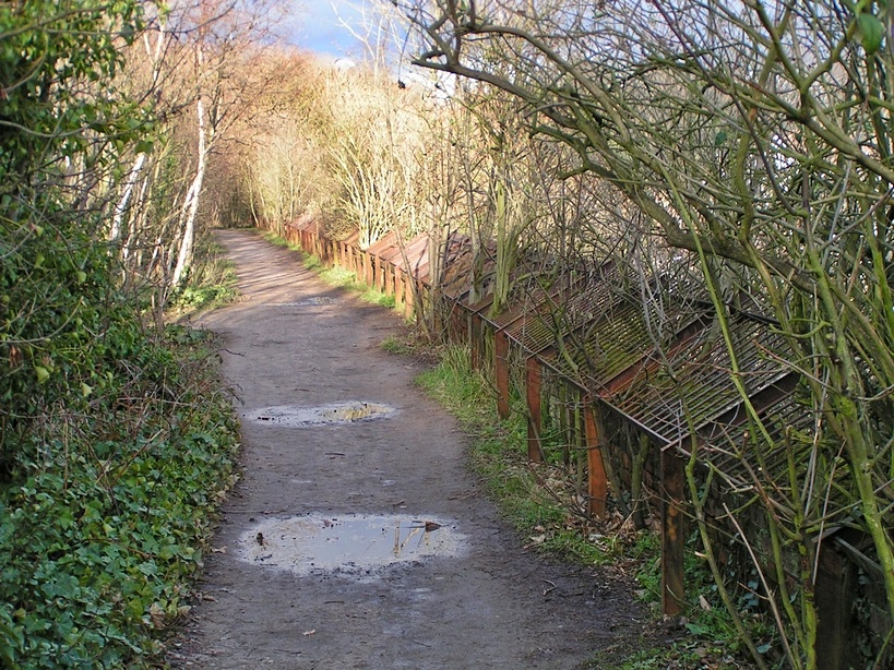
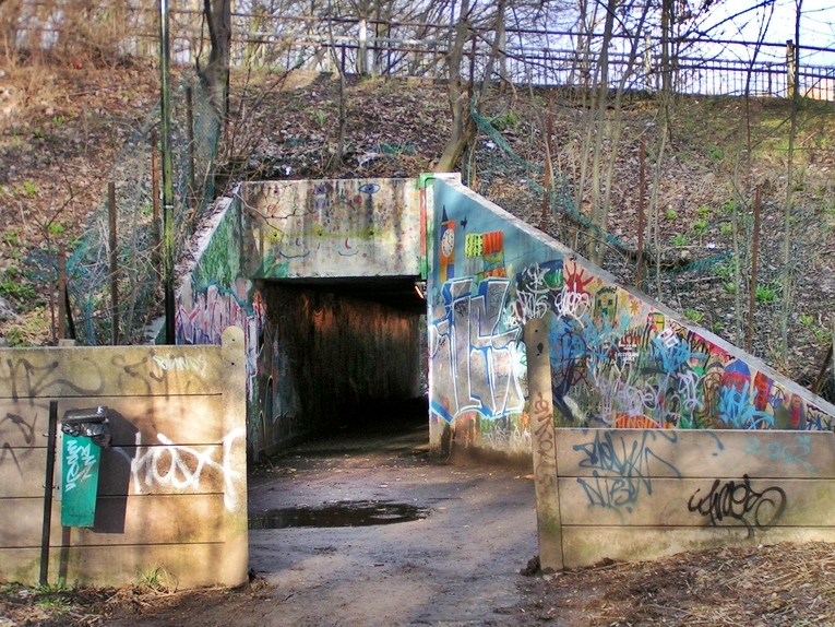
The Northern Heights Line - Finsbury Park to Alexandra Palace (Parkland Walk)
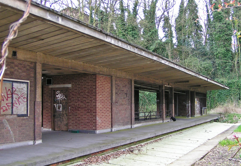
The abandoned Highgate (high level) Railway Station (2004)
This railway ran from Finsbury Park via Stroud Green, Crouch End, Highgate Cranley Gardens, Muswell Hill to Alexandra Palace. In its heyday in the 1870s the line carried 60,000 passengers on one Whit Monday.
The platforms of Crouch End Station still survive and the abandoned Highgate (high level) Railway Station opened in 1867 still sits directly above Highgate tube station (which opened in 1941). Because of the hilly terrain, the station was built in a deep cutting with tunnels at each end of the station. The original high level station buildings were demolished during the Second World War and a new central platform with reinforced concrete canopies were built, including a stairway leading down to the new Highgate Northern Line ticket hall.
Passenger trains continued to run on this line until 1954. The service was reduced to freight haulage and tube traffic, until its final closure in 1970.
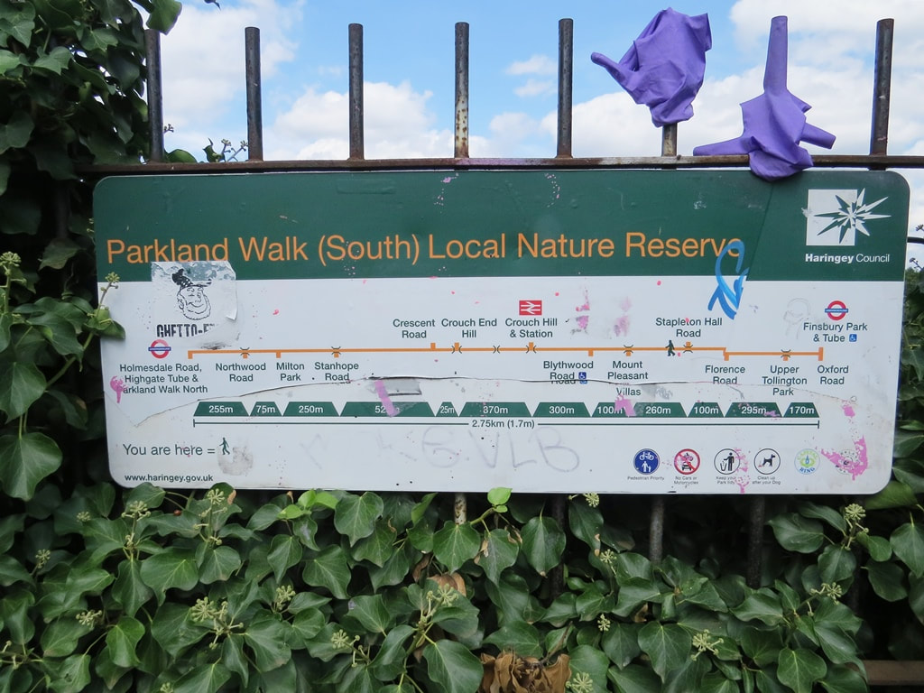
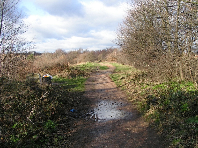
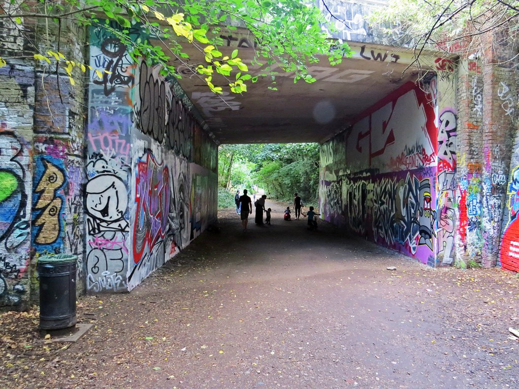
The trackbed has been converted into the PARKLAND WALK that alternates between running along the top of an embankment and through deep wooded cuttings of the original railway. It is London's longest local nature reserve.
"Dramatic increases in anti-social behaviour, including drinking, drug taking and sexual activity have contributed to a public perception that the parkland walk is a no-go area, according to a council report" Hampstead & Highgate Express
"And only footsteps in a lane, and birdsong broke the silence sound and chuffs of the Great Northern train for Alexandra Palace bound" - Diary of a Nobody by John Betjeman
The platforms of Crouch End Station still survive and the abandoned Highgate (high level) Railway Station opened in 1867 still sits directly above Highgate tube station (which opened in 1941). Because of the hilly terrain, the station was built in a deep cutting with tunnels at each end of the station. The original high level station buildings were demolished during the Second World War and a new central platform with reinforced concrete canopies were built, including a stairway leading down to the new Highgate Northern Line ticket hall.
Passenger trains continued to run on this line until 1954. The service was reduced to freight haulage and tube traffic, until its final closure in 1970.
The trackbed has been converted into the PARKLAND WALK that alternates between running along the top of an embankment and through deep wooded cuttings of the original railway. It is London's longest local nature reserve.
"Dramatic increases in anti-social behaviour, including drinking, drug taking and sexual activity have contributed to a public perception that the parkland walk is a no-go area, according to a council report" Hampstead & Highgate Express
"And only footsteps in a lane, and birdsong broke the silence sound and chuffs of the Great Northern train for Alexandra Palace bound" - Diary of a Nobody by John Betjeman


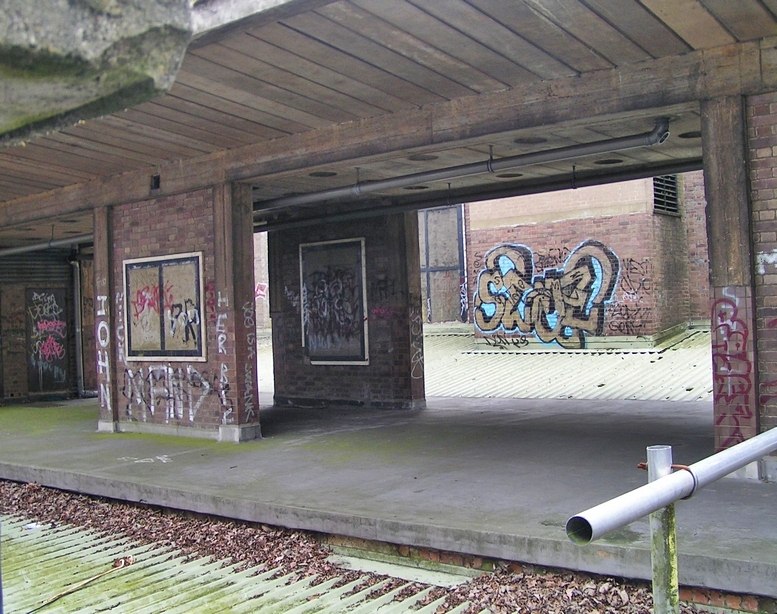
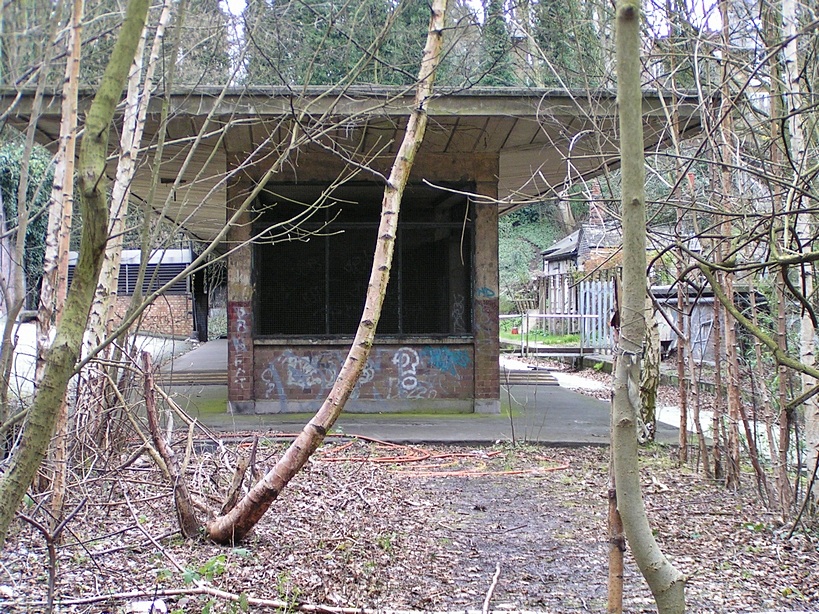


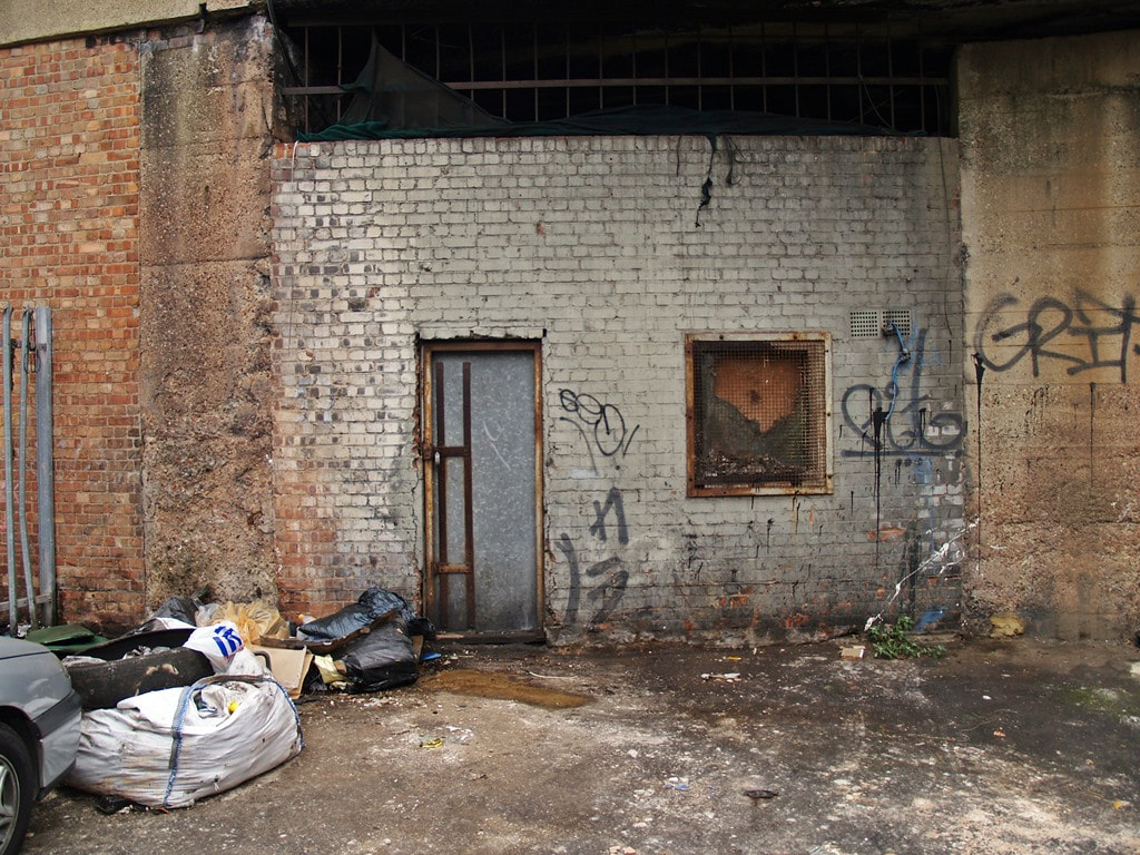
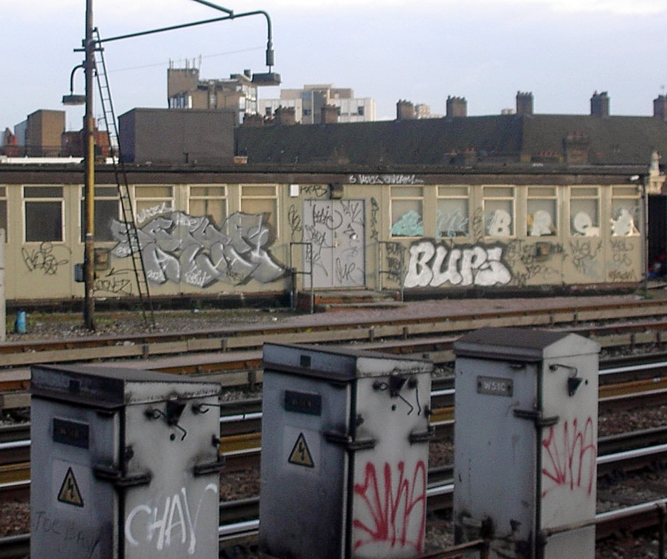
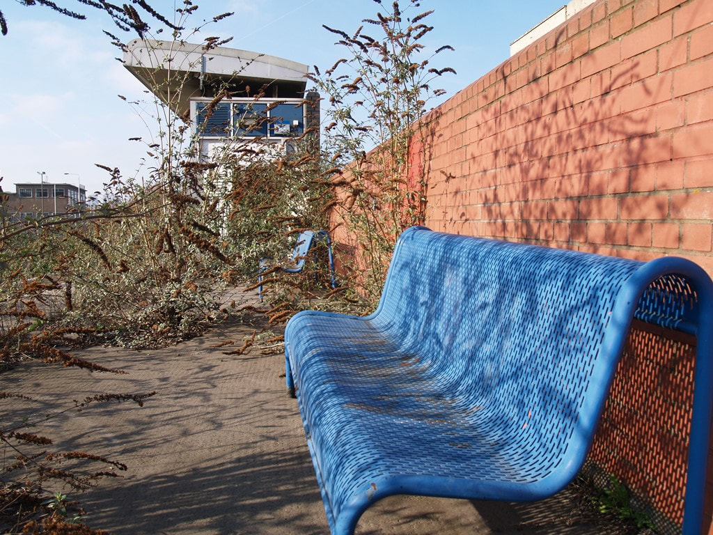
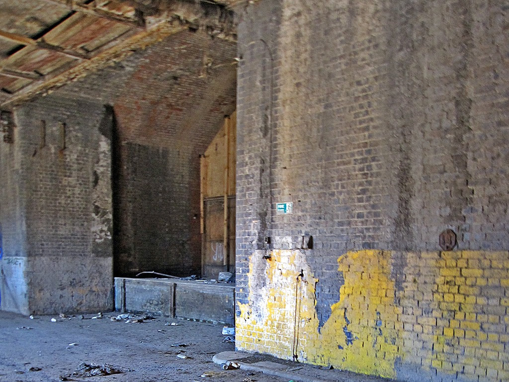
Plaistow Station, E13 - Disused Buildings
The Fenchurch Street–Southend service was withdrawn from Plaistow and these buildings and platforms used by that service have been abandoned since 1962. These photographs were taken in 2003, but they still remain derelict while the rest of the station is fully functioning.
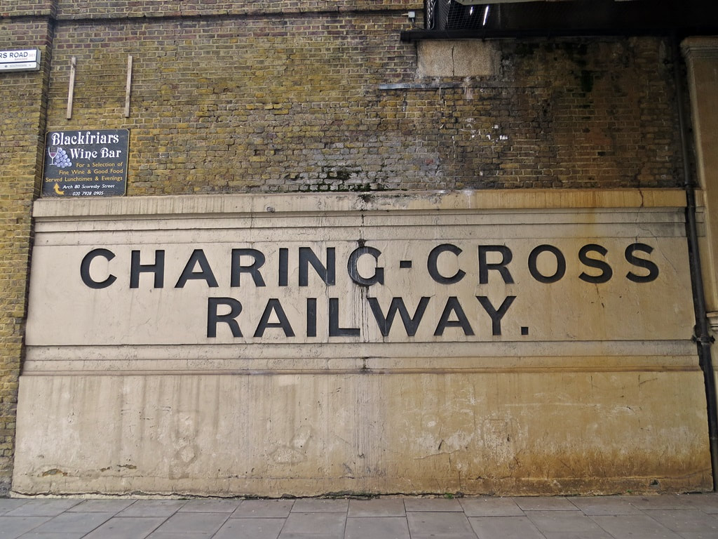
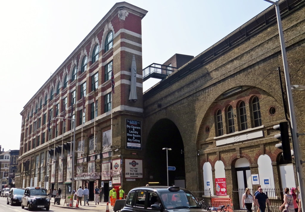
Blackfriars Road, SE1 - Former South East Railway Blackfriars Station
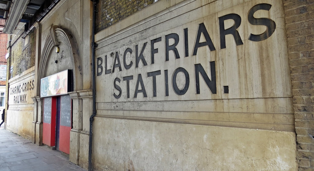
Blackfriars Road, SE1 - Former South East Railway Blackfriars Station
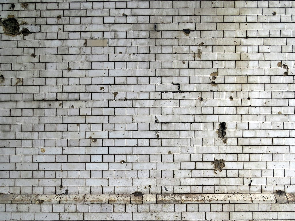
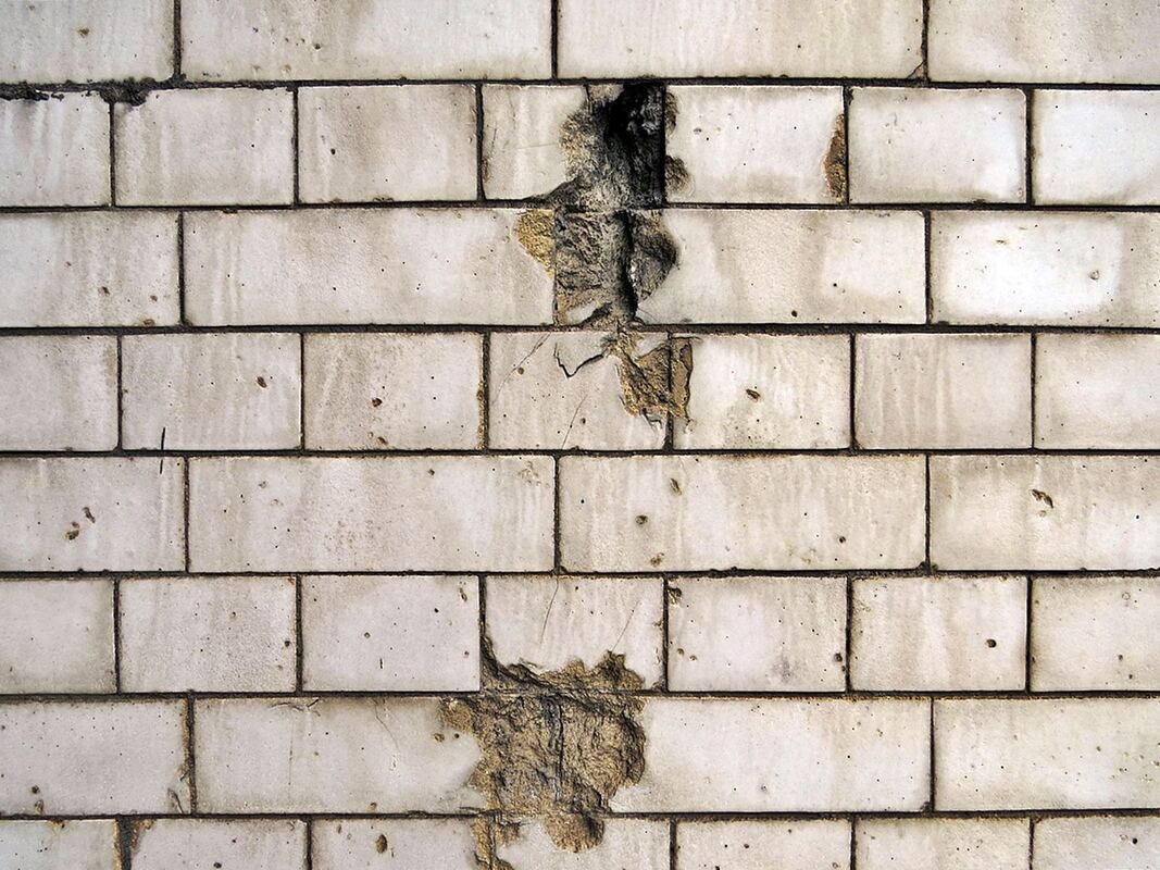
Surprising modern day evidence of a station that was only open for 5 years. This is the entrance to the former SER Blackfriars Station. Situated on the Blackfriars Road opposite the present day Southwark tube station. The tiling under the bridge on both sides of the road still shows evidence of World War Two shrapnel damage from the Blitz of 1940 and a V2 rocket in 1944. Many surrounding buildings were damaged beyond repair. More visible evidence of wartime London can be seen on the Derelict London War page.
Work on the station was commenced by the Charing Cross Railway Co on its line from London Bridge to Charing Cross, and it was taken over by the South Eastern Railway Co. before opening in 1864. Closure came 5 years later when the South East Railway opened its Waterloo Station (now Waterloo East). In 1886 the London, Chatham and Dover Railway (LCDR) opened a station on the north bank of the river called St. Paul's and renamed Blackfriars in 1937.
The Big Burrito Company were based under the arch but that had closed down when these pics were taken and the Lebanese Grill has since opened in its place. A while ago there was a café called The Toast Office with a great mock Post Office sign. There were plans to encase half the pavement area in glass to accommodate a trendy café but there is no update on those plans.

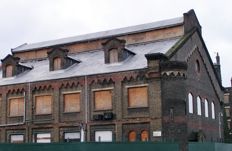
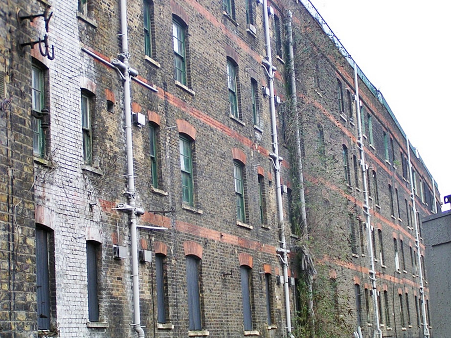
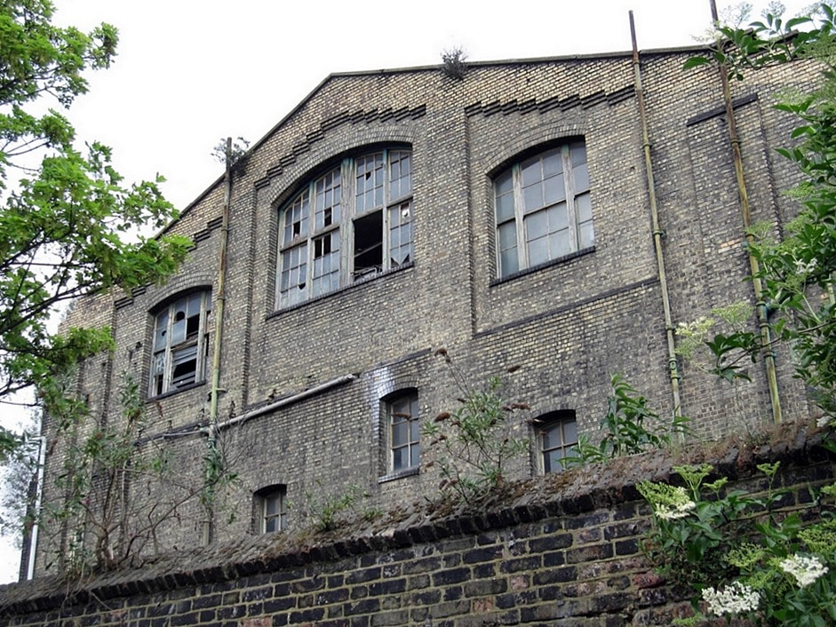
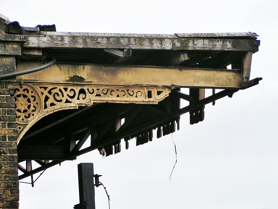
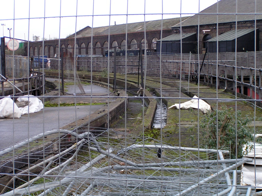
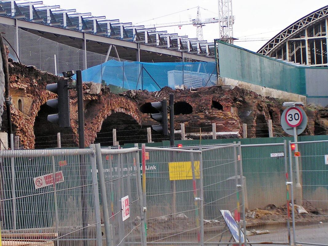
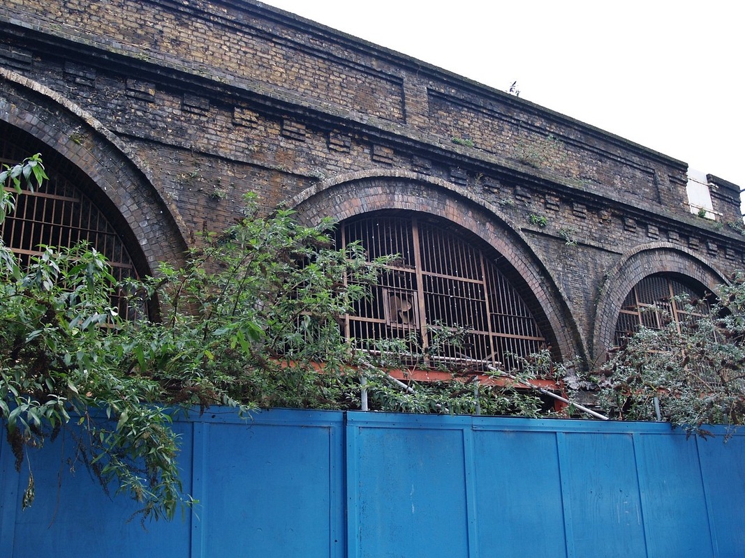
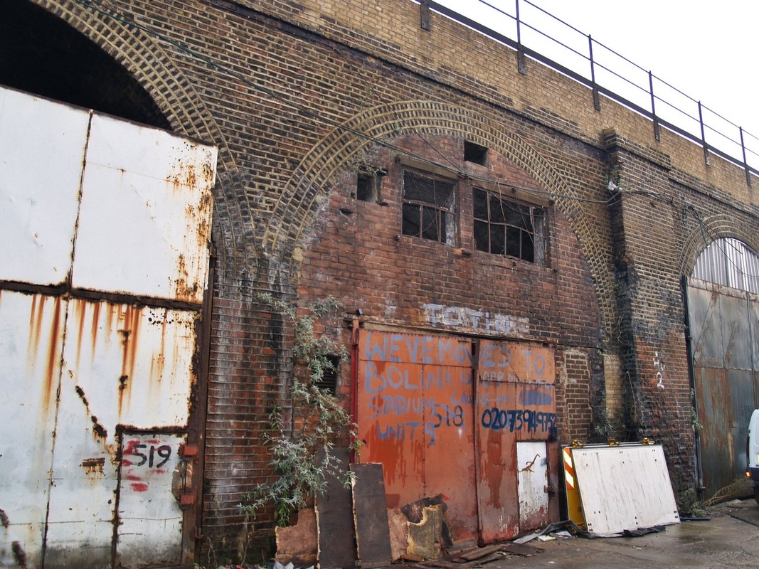
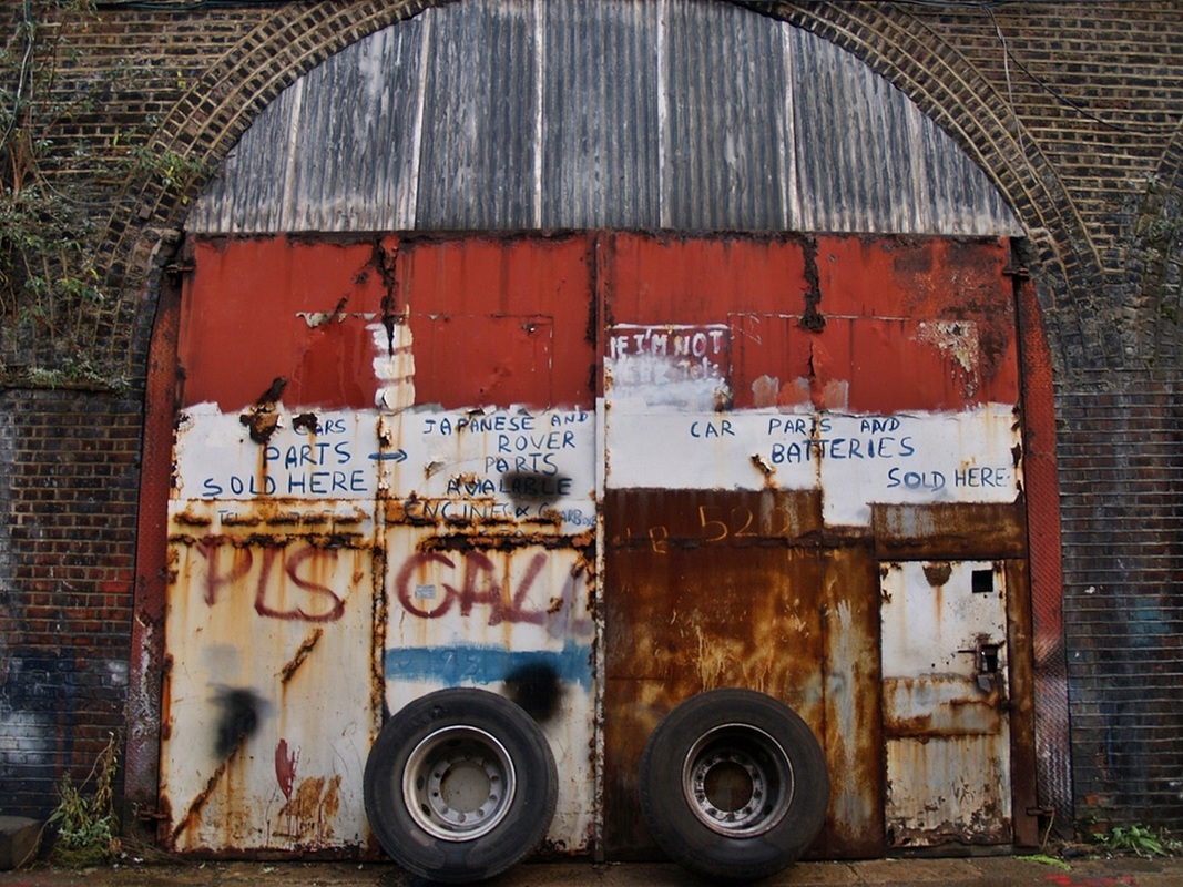
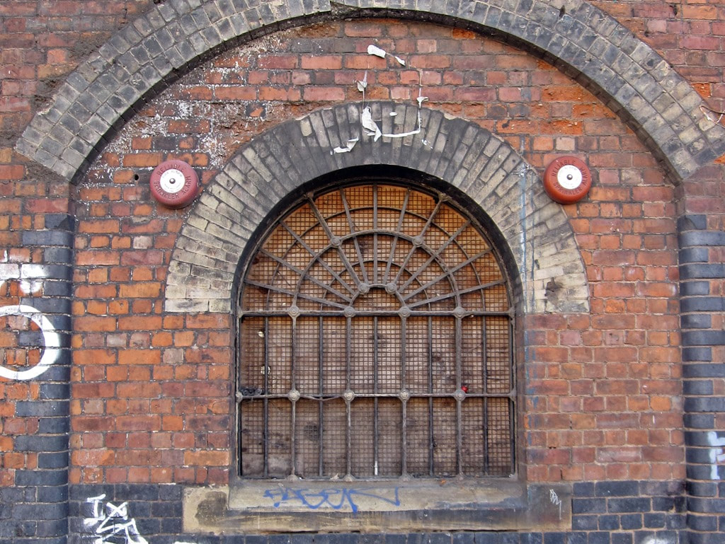
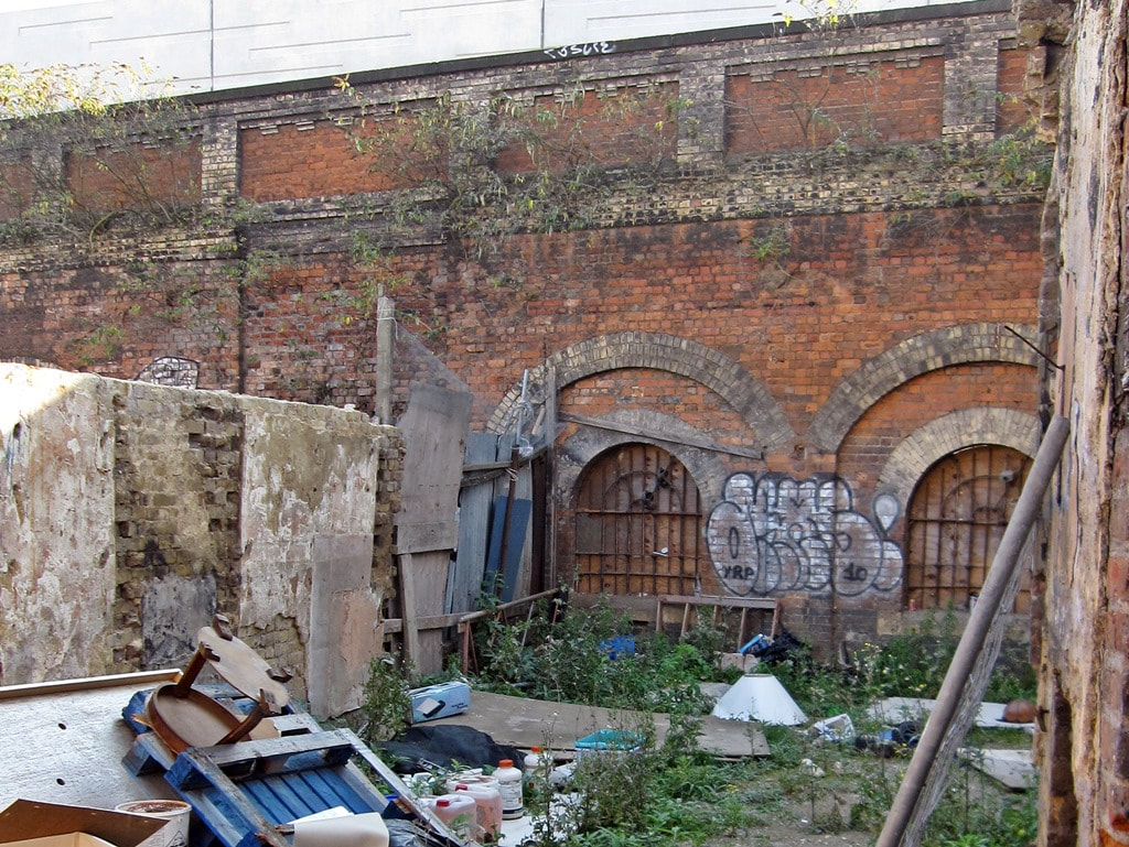
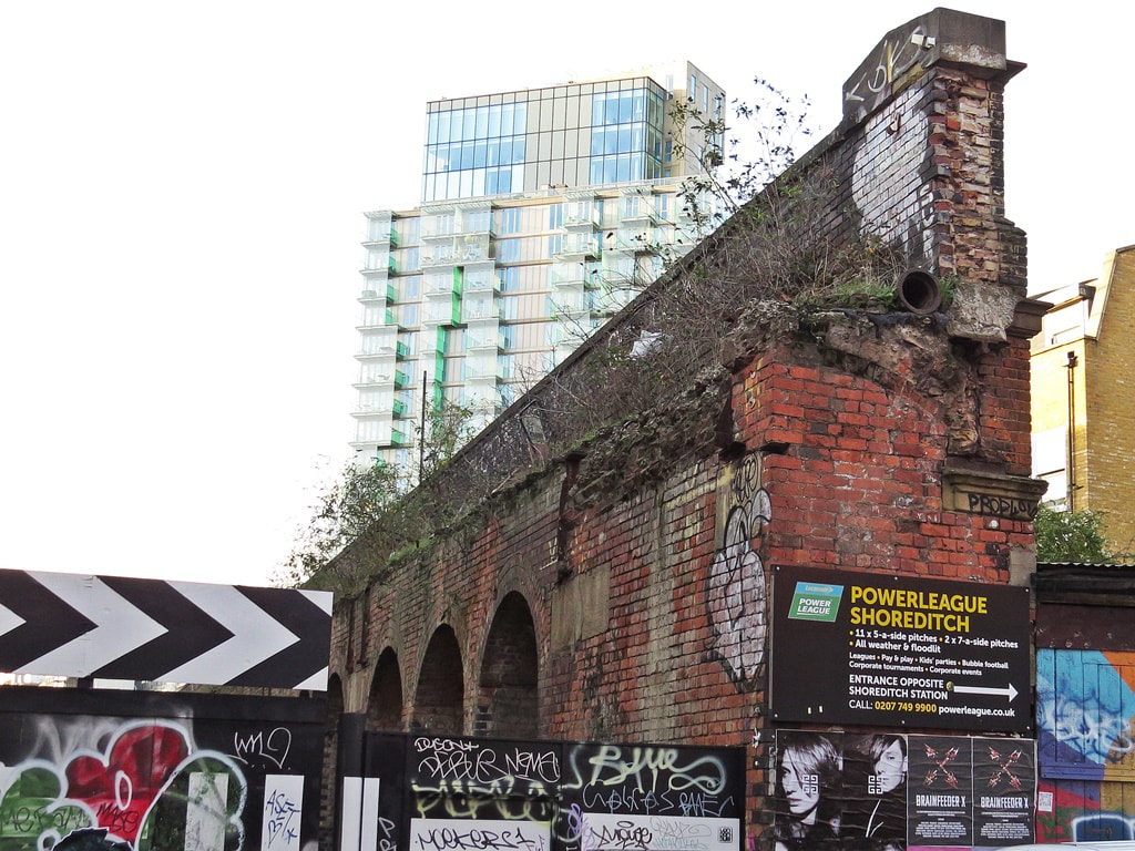
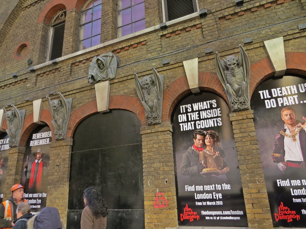
Shoreditch, E1 - Bishopsgate Goods Yard
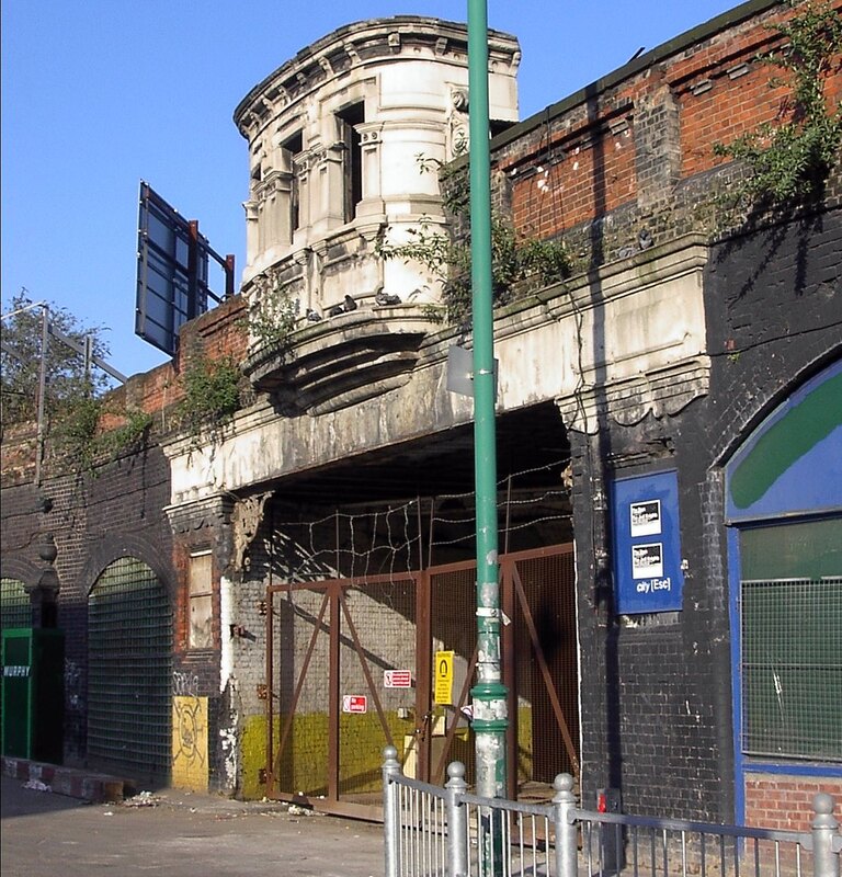
The Grade II listed Oriel Gate into the Bishopsgate Goodsyard (2003). It is still there but has been obscured by boards for many years.
Bishopsgate was a railway station in use from 1840 to 1875 as a passenger station and then converted into a freight terminal. By 1882 the Goodsyard was in full operation catering for 1,600 carts in and out of the station daily and was the focus for receiving imported food via the eastern ports from continental Europe.
Bishopsgate Goodsyard was destroyed in a fire in 1964 which killed two customs officials and destroyed hundreds of railway wagons, dozens of motor vehicles and millions of pounds worth of goods. Regeneration has been very slow with one of the reasons is that the site stretches across the borough boundary between Tower Hamlets and Hackney.
Substantial remains lay derelict until much was demolished in the early 2000s to make way for Shoreditch High Street railway station which now stands on the site.
A mixed-use development named The Goodsyard has been proposed for the remainder of the site.


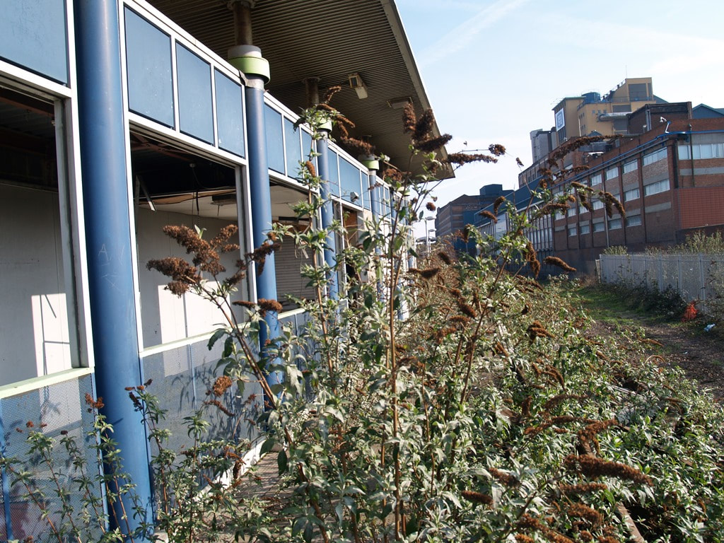
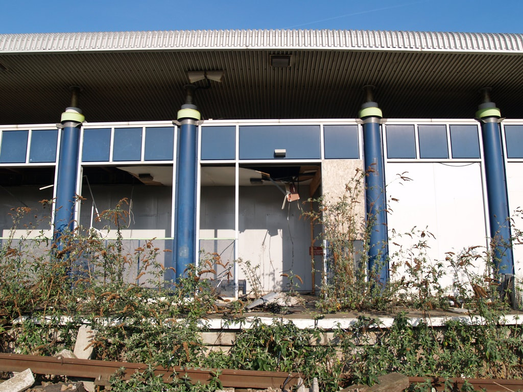
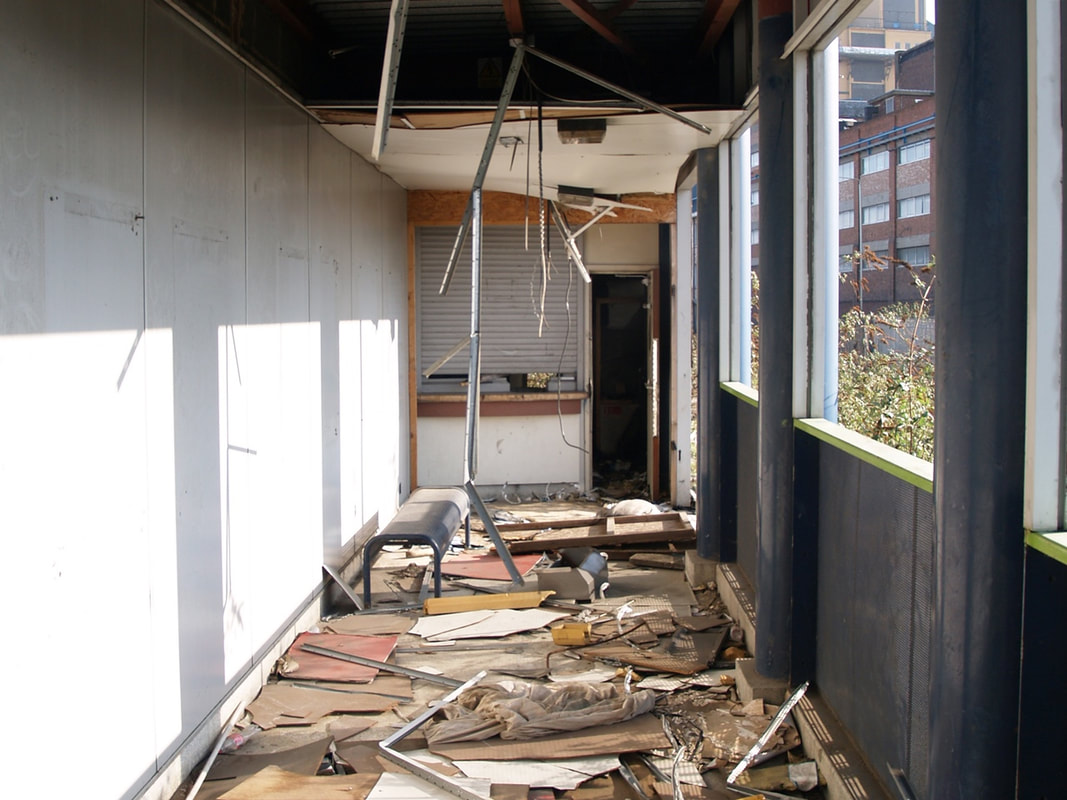
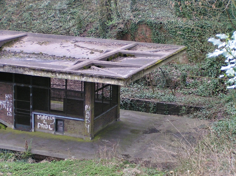
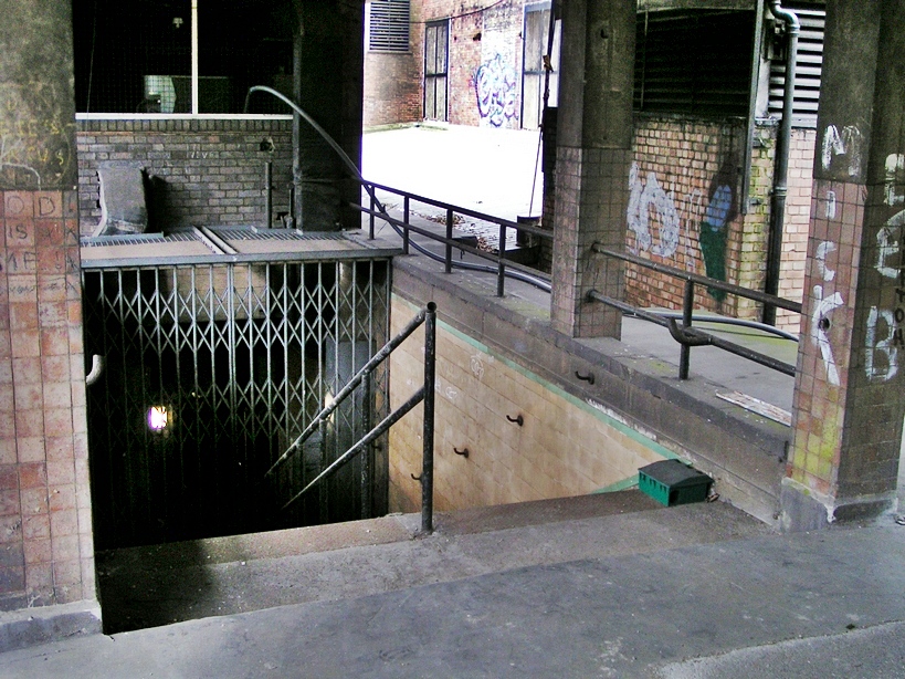
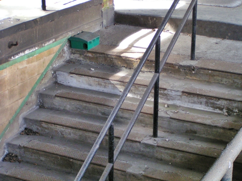
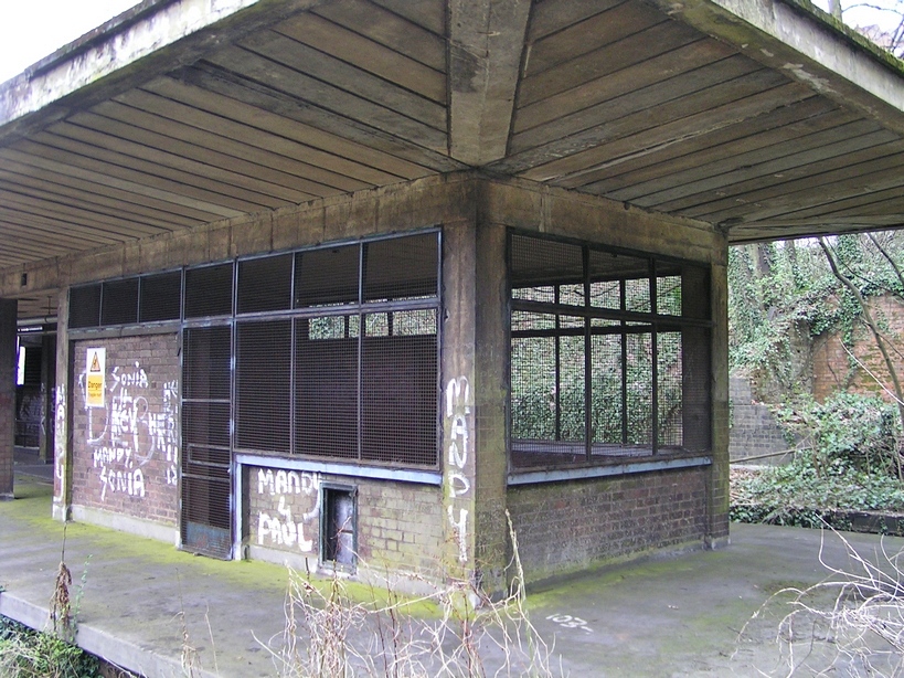
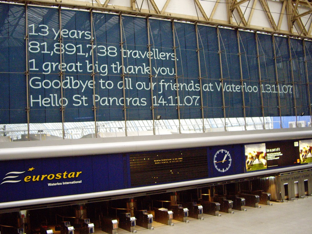
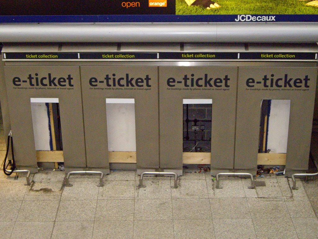
Waterloo Station, SE1 - Waterloo International Railway Station
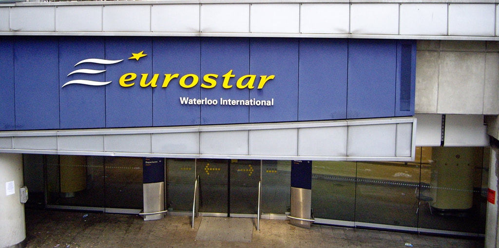
Waterloo Station, SE1 - Waterloo International Railway Station (2008)
Waterloo International station was the London terminus of the Eurostar international rail service from its opening in 1994 to its closure on 2007, when it was replaced by St Pancras International as the terminal for international rail services.
This £130m station, designed by Nicholas Grimshaw, was widely admired. It won the best building prize from the Royal Institute of British Architects for its "power and elegance" in 1994. After laying empty for a decade the platforms were incorporated into the main Waterloo station. In 2010 two of the disused platforms hosted theatrical performances of The Railway Children. The audience was seated either side of the actual railway track. The show includes the use of a steam engine, coupled to one of the original carriages from the 1970 film being shunted in and out of the theatre area.
This £130m station, designed by Nicholas Grimshaw, was widely admired. It won the best building prize from the Royal Institute of British Architects for its "power and elegance" in 1994. After laying empty for a decade the platforms were incorporated into the main Waterloo station. In 2010 two of the disused platforms hosted theatrical performances of The Railway Children. The audience was seated either side of the actual railway track. The show includes the use of a steam engine, coupled to one of the original carriages from the 1970 film being shunted in and out of the theatre area.


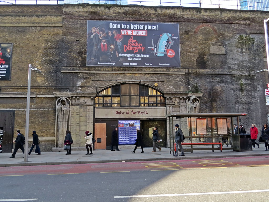
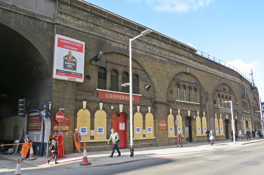
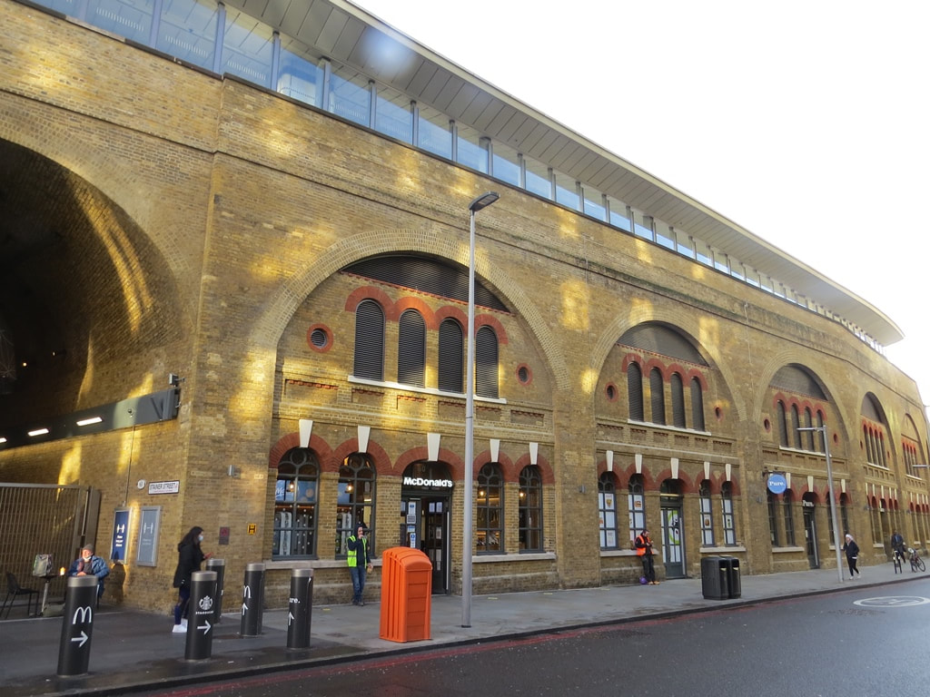
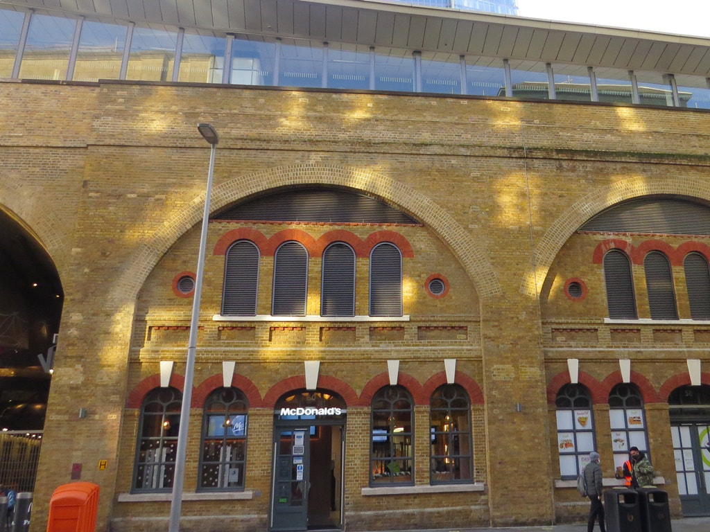
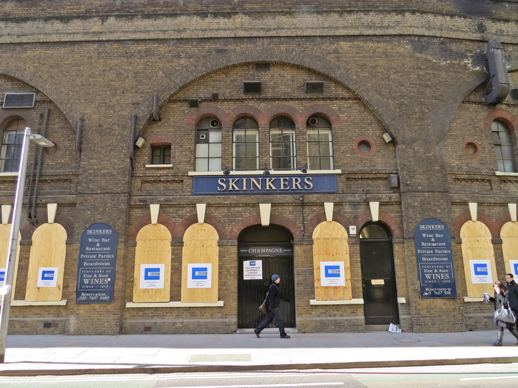
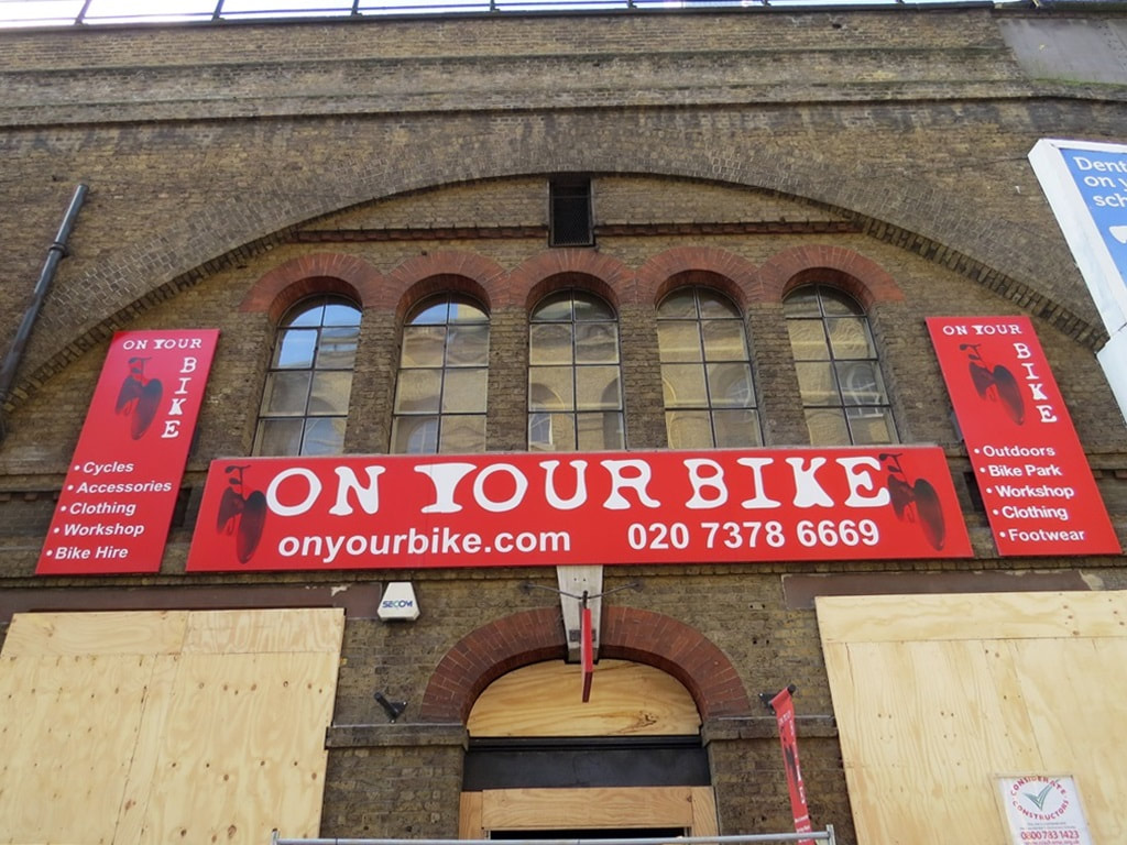
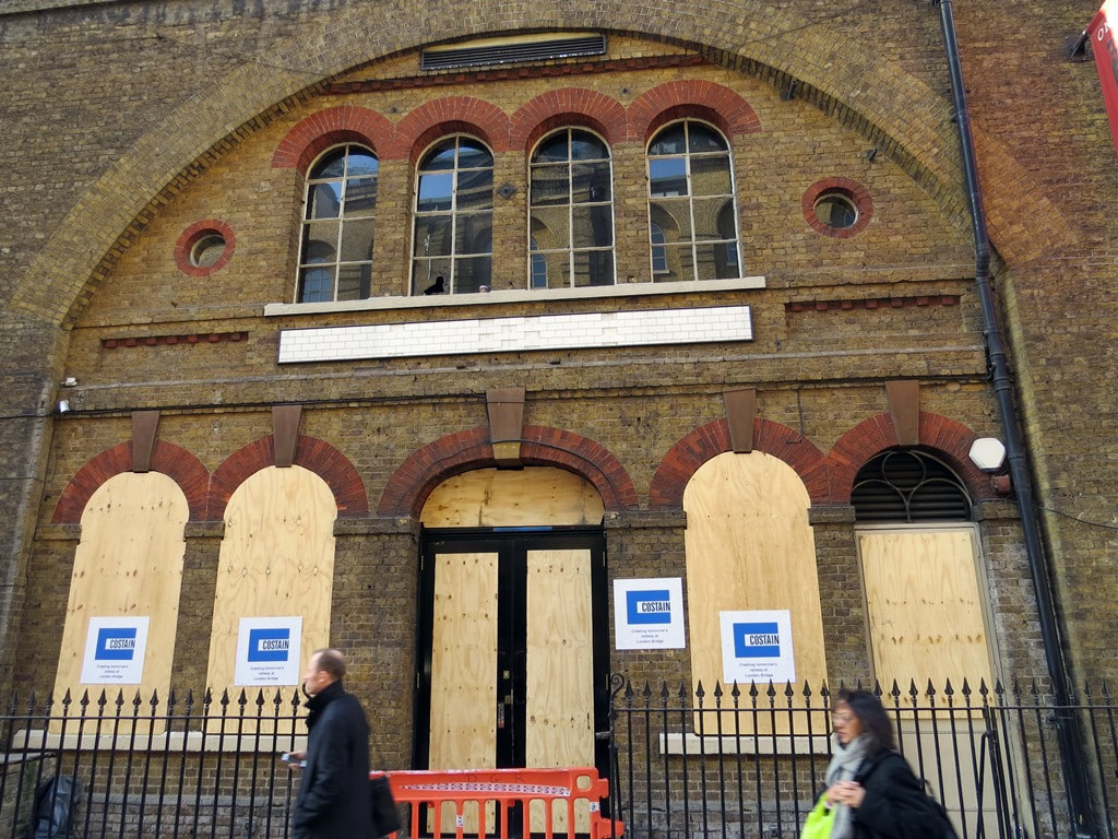
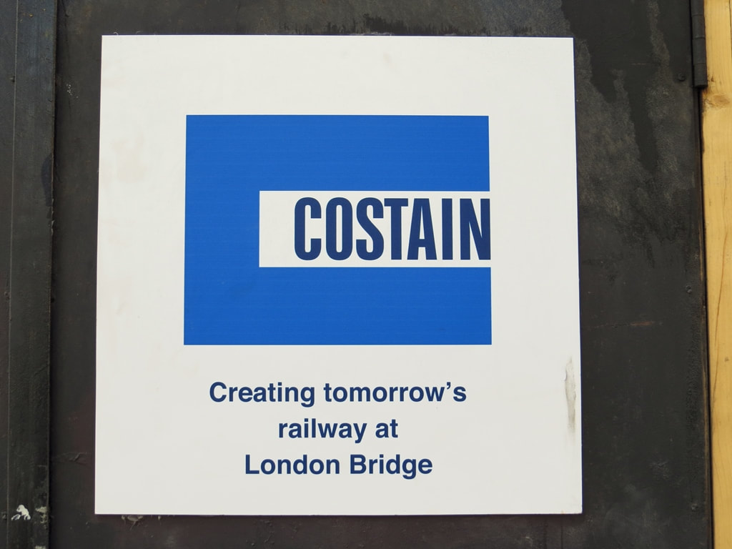
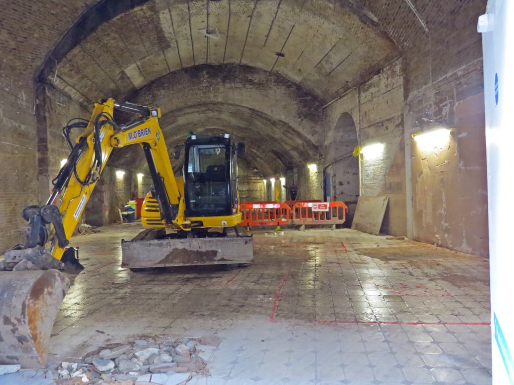
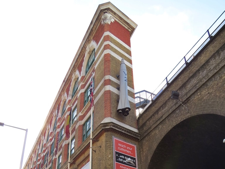
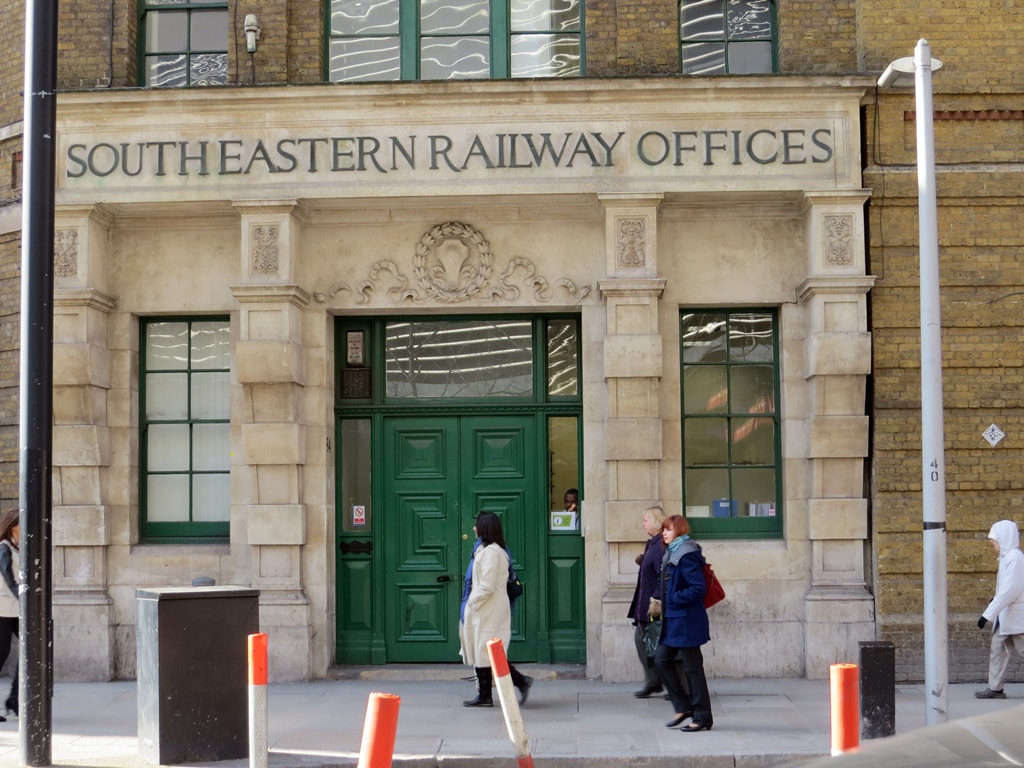
London Bridge Station, SE1 - Redevelopment Before (2013) and After (2021)
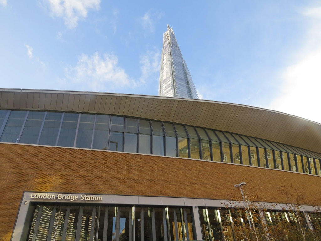
Tooley Street was a building site for 5 years as a new ground-level concourse for the mainline rail station was created with the loss of some distinctive attractions and architecture. This is a selection of my photographs taken in 2013 and some up top date ones taken in roughly the same position.
The London Dungeons have relocated to the old County Hall next to the London Eye. The horror attraction sold off many of its old props and exhibits at a car boot sale. The On Your Bike bicycle shop relocated to new premises adjacent to Borough Market. Skinkers Wine Bar closed its doors after 38 years and its sister establishment The Cooperage closed after a nearly 30 years in Tooley Street.
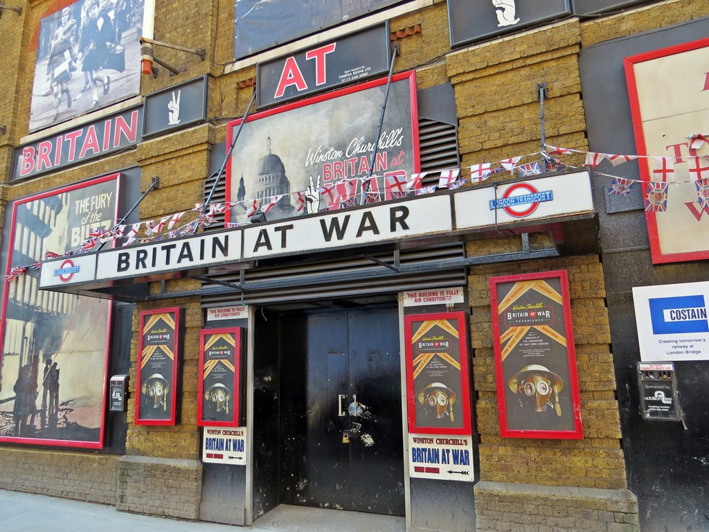
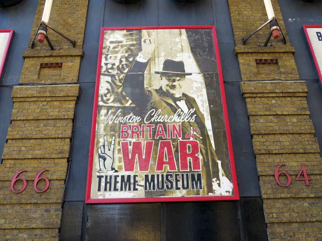
The former South Eastern Railway offices, a triangular 'Flat iron' block was home to a WW2 museum and a restaurant was demolished, and a public plaza was created in front of the station concourse. The Winston Churchill's Britain at War Experience closed in 2013 and never relocated. The building survived the Luftwaffe but not the modern-day developers. Unfortunately, efforts to get the building a listed status were unsuccessful despite Tooley Street being deemed a "conservation area" by Southwark Council.
The London Dungeons have relocated to the old County Hall next to the London Eye. The horror attraction sold off many of its old props and exhibits at a car boot sale. The On Your Bike bicycle shop relocated to new premises adjacent to Borough Market. Skinkers Wine Bar closed its doors after 38 years and its sister establishment The Cooperage closed after a nearly 30 years in Tooley Street.
The former South Eastern Railway offices, a triangular 'Flat iron' block was home to a WW2 museum and a restaurant was demolished, and a public plaza was created in front of the station concourse. The Winston Churchill's Britain at War Experience closed in 2013 and never relocated. The building survived the Luftwaffe but not the modern-day developers. Unfortunately, efforts to get the building a listed status were unsuccessful despite Tooley Street being deemed a "conservation area" by Southwark Council.


Below are a few more Tooley Street photographs taken in 2013
Tooley St, SE1 - South Eastern Railway offices (2013)


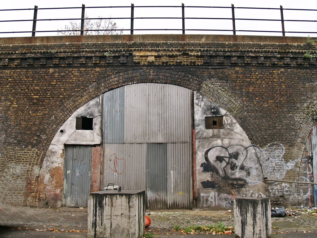
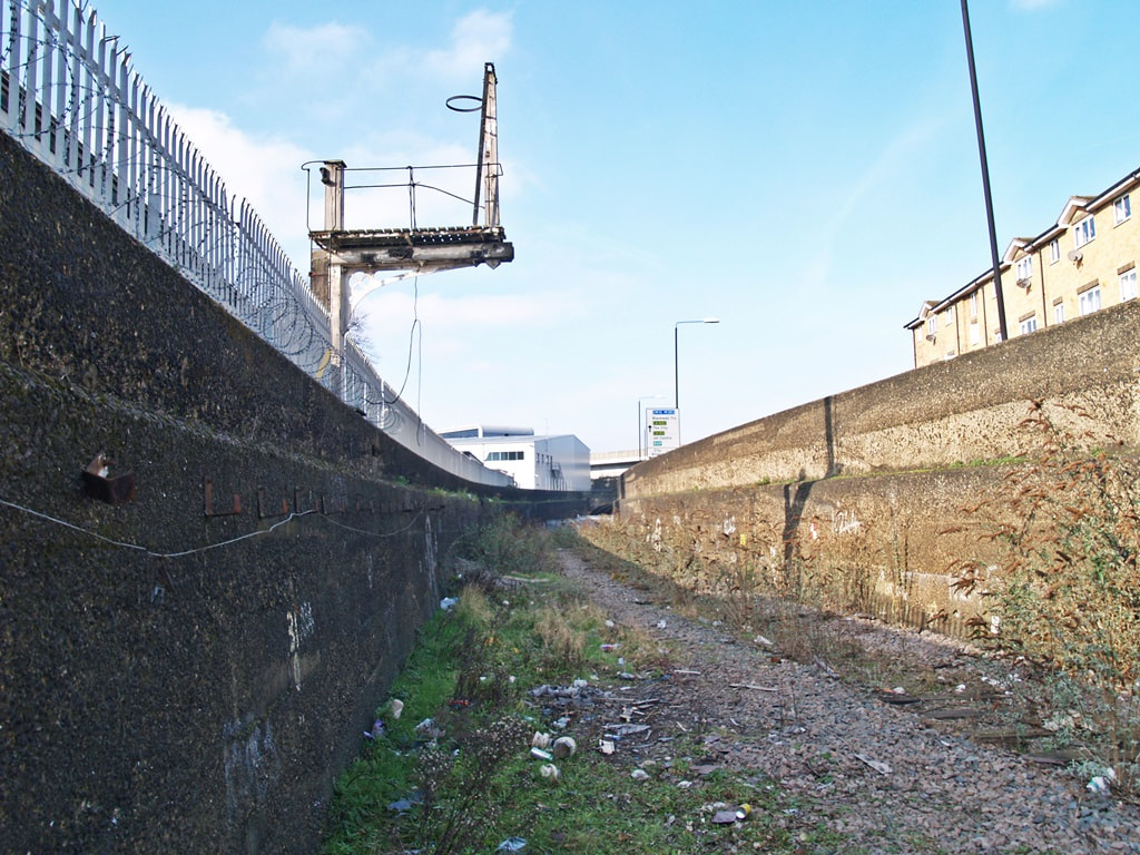
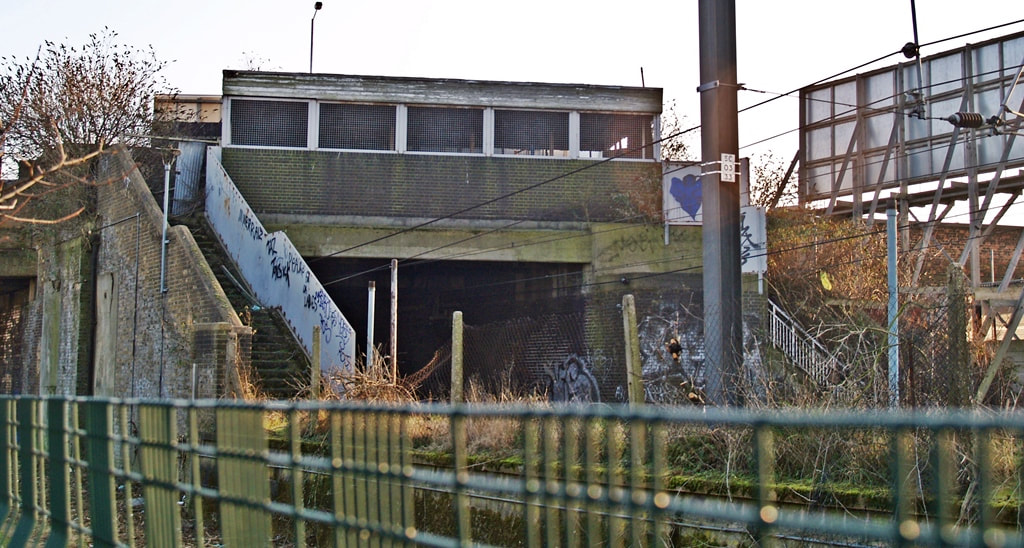
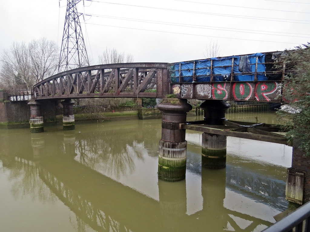
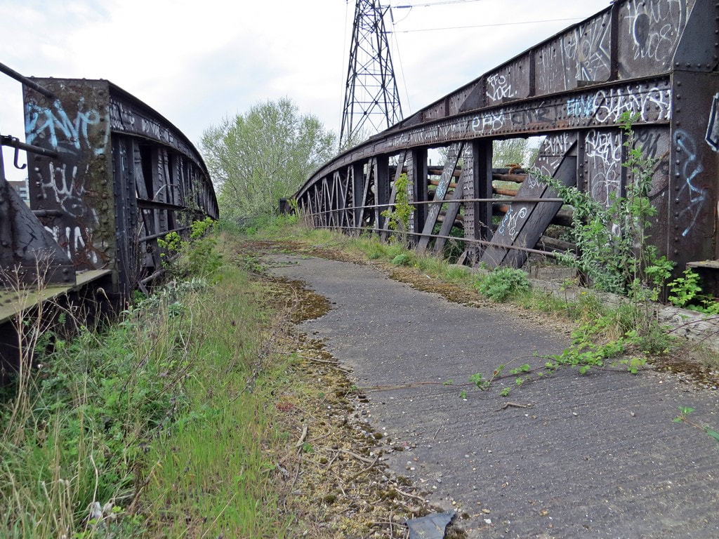
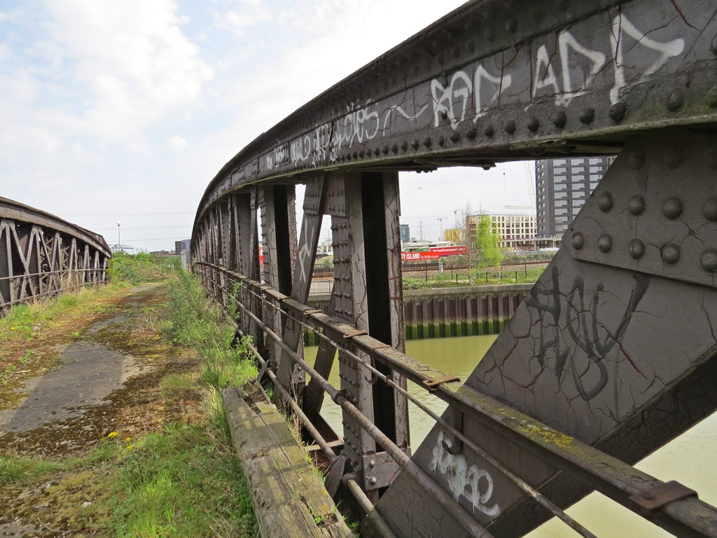
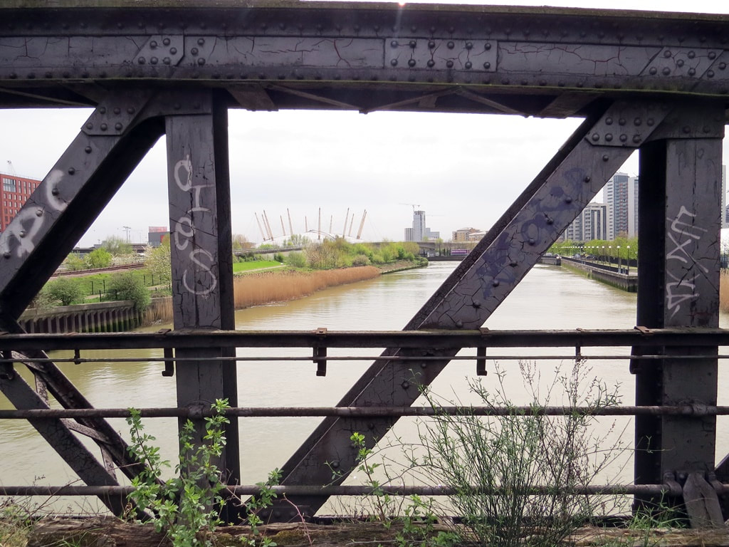
Canning Town, E16 - Abandoned Railway Bridge
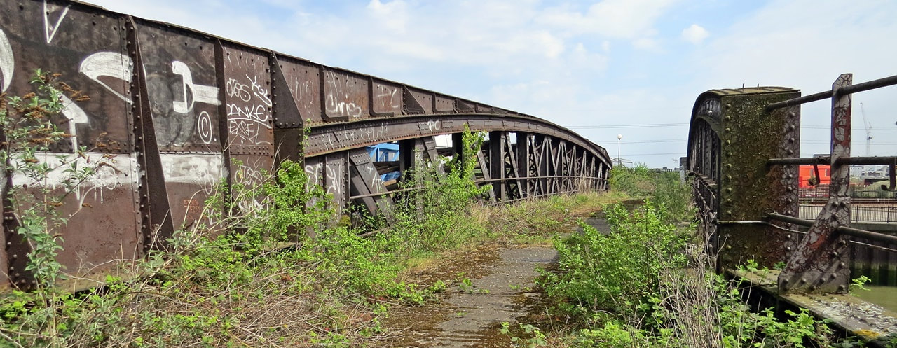
Canning Town, E16 - Abandoned Railway Bridge (2020)
A railway bridge on this site goes back to 1848 with this one replacing a swing bridge in the early 1900s. The bridge was used to carry the goods line over Bow Creek (the tidal River Lea) from Canning Town to sidings that served the former East India Dock warehouses. The railway closed in 1967 around the same time as the East India Docks. The bridge is sealed off to the public, but I managed to get up there myself for some photographs. The Crunch (a supergroup)used it in their promo video for their Neon Madonna single in 2015. A supergroup in my household anyway as it includes members of Sham 69, Cockney Rejects, The Clash & Diamond Dogs.
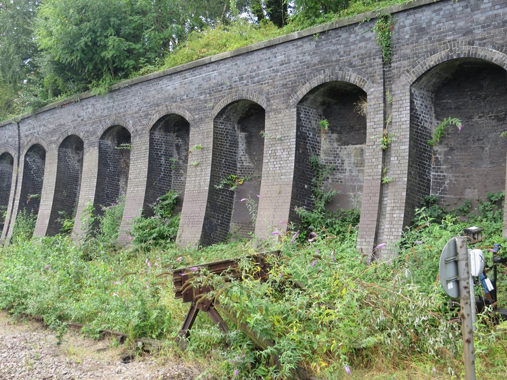
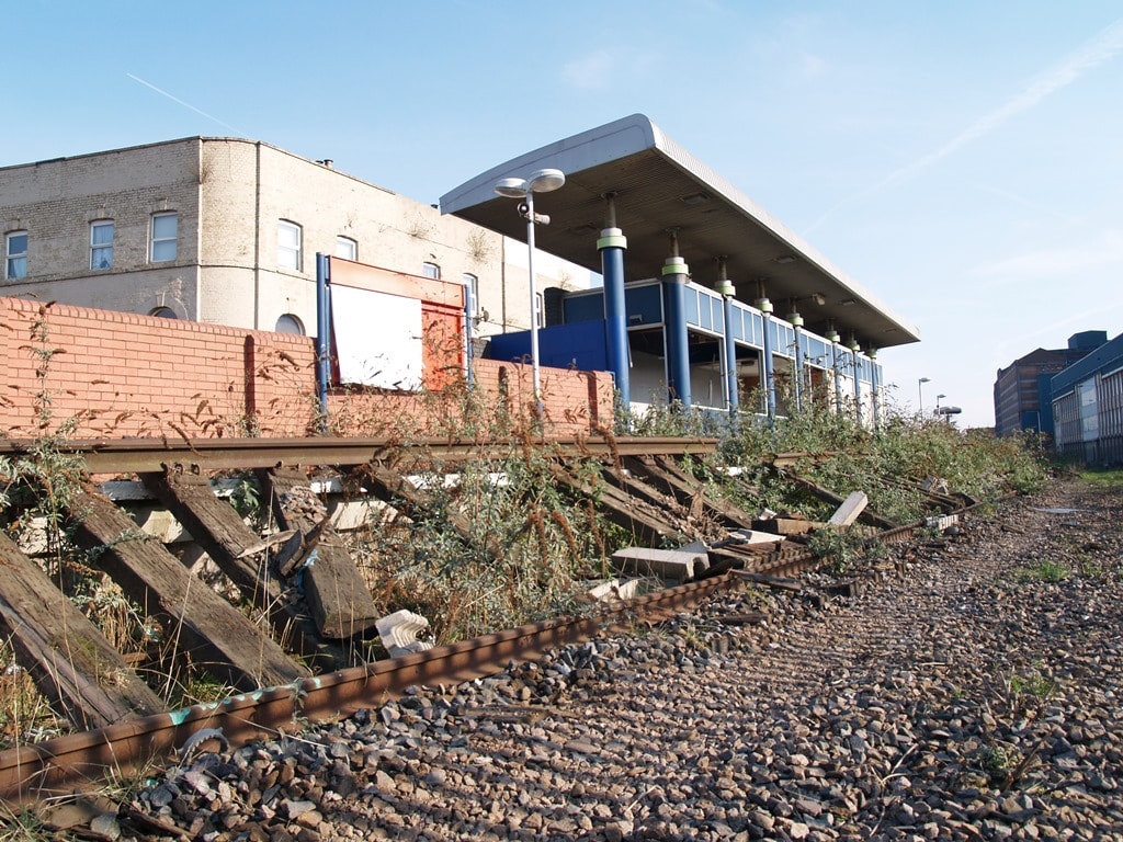
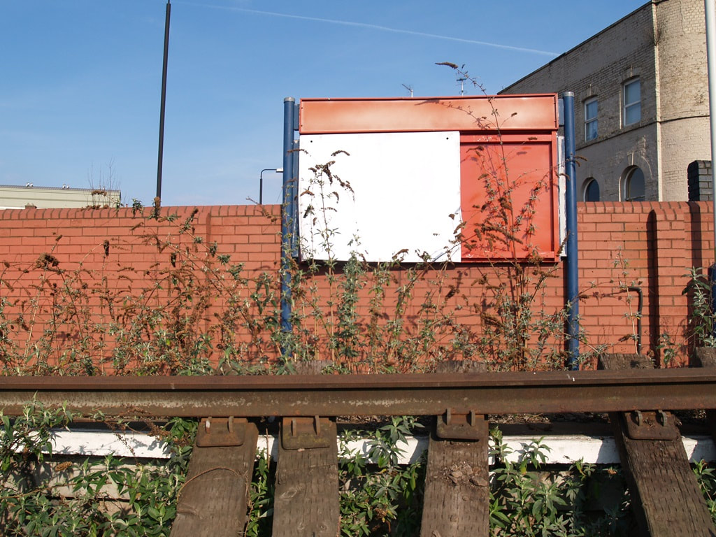
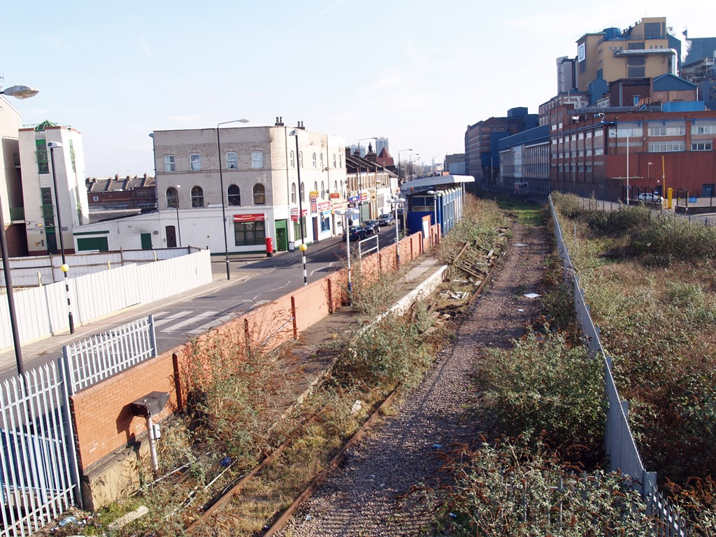
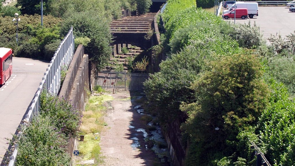
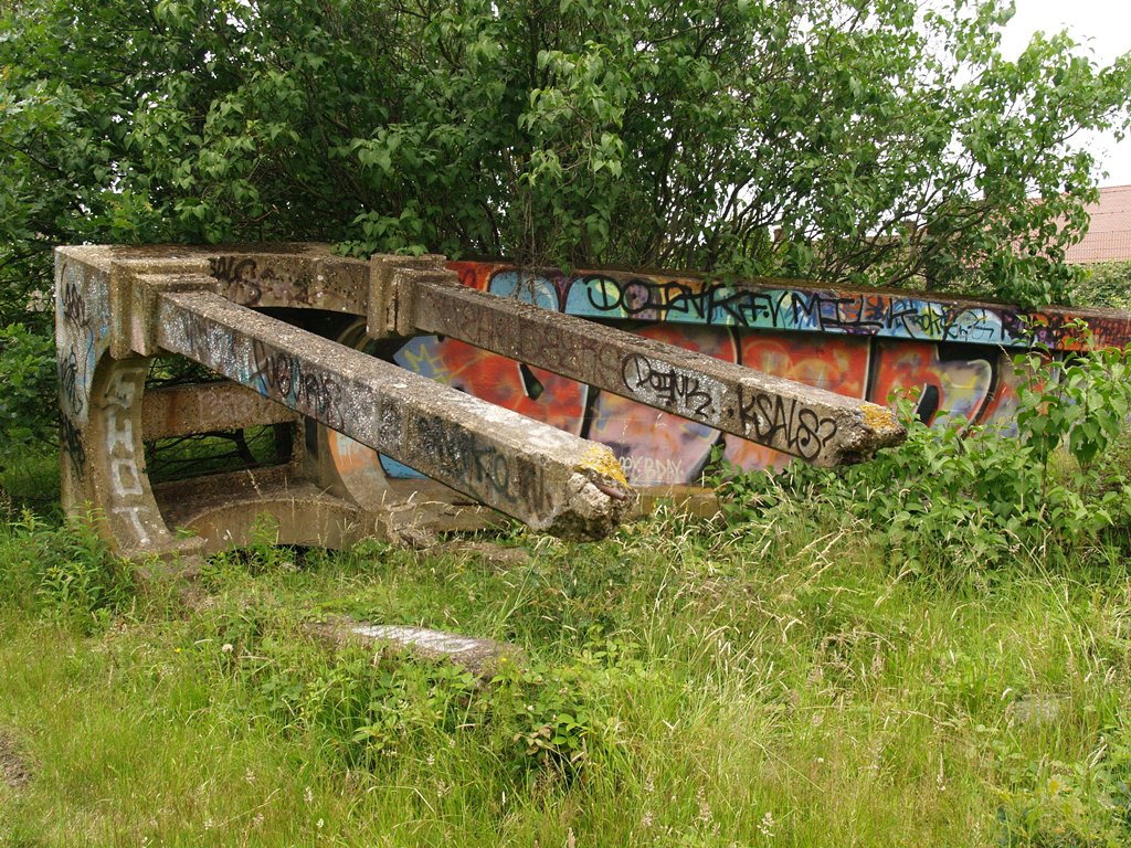
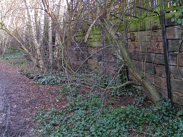
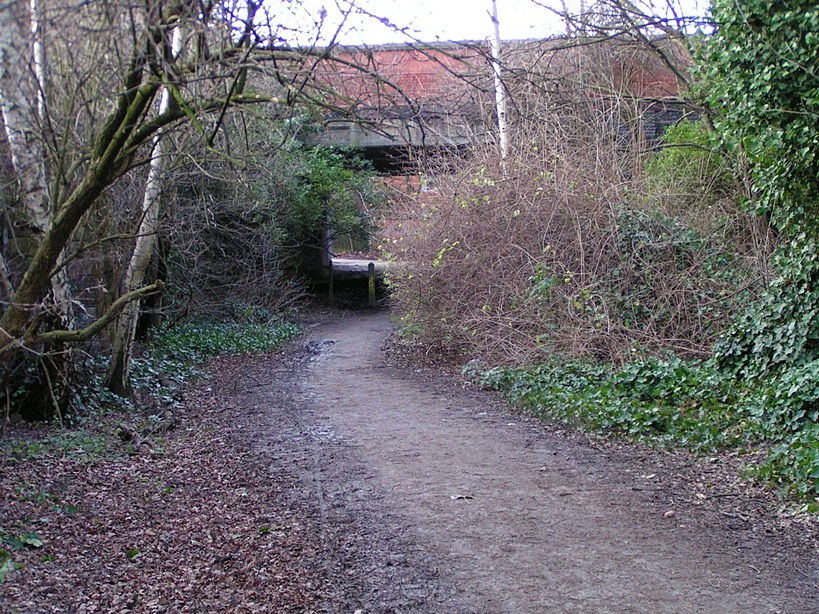
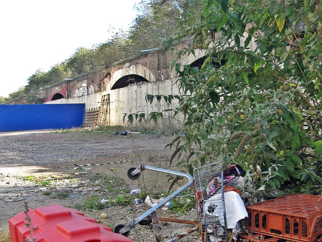
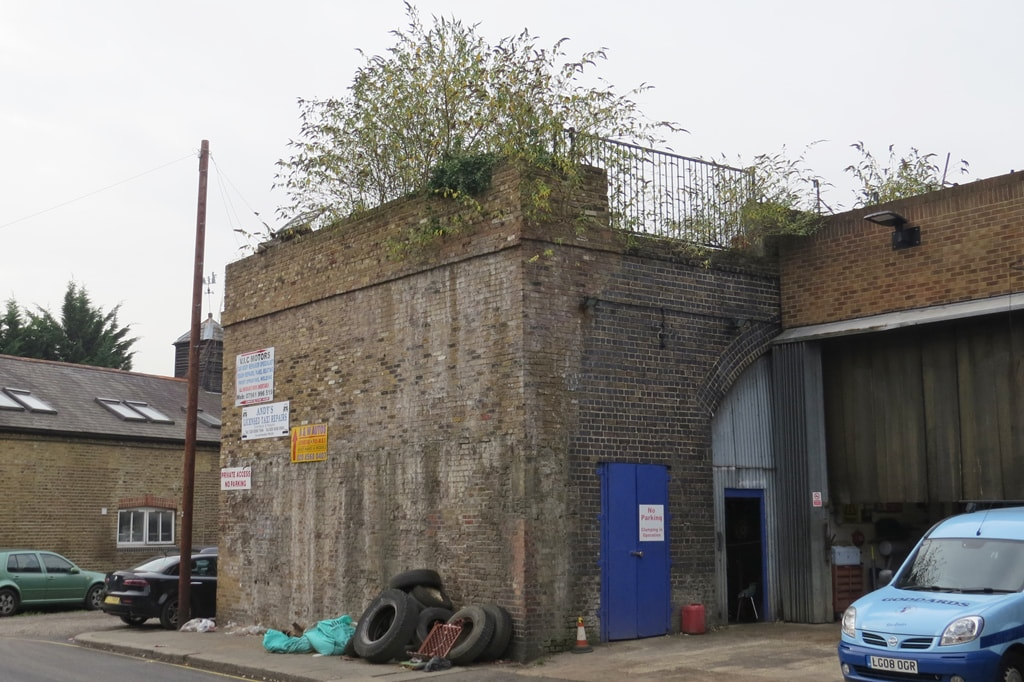
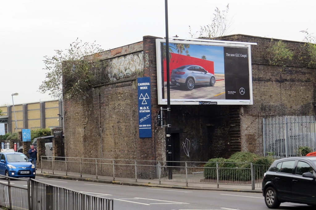
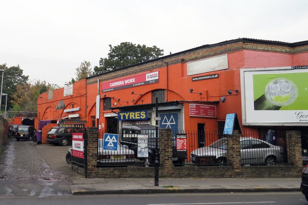
Brentford, TW7 - Brentford Branch Line (aka Brentford Dock Line)
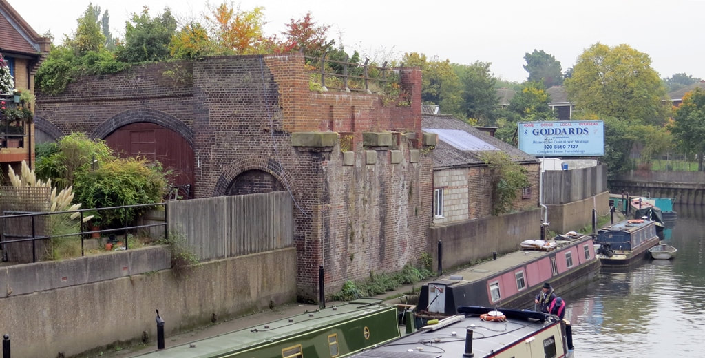
Brentford, TW7 - Remains of Viaducts of the Brentford Branch Line (aka Brentford Dock Line)
The Brentford branch line aka the Brentford Dock Line, was mainly a freight railway branch line which opened in 1859. It ran 4 miles from Southall to Brentford Dock via Brentford Town Goods (a station that opened in the line later in 1930). The line to the wharves was also closed after which this line south of Brentford Town (Goods) Station was dismantled. As you can see here parts of the viaduct which carried the line into the dock remain intact.
Brentford Town Goods itself closed in 1970. In 1977, a waste transfer station opened on the site of the yard, after the Greater London Council did a deal with British Rail to use the line for the transport of rubbish. Four trains a week still serve the waste station transporting rubbish to a landfill site in Oxfordshire.
Brentford Town Goods itself closed in 1970. In 1977, a waste transfer station opened on the site of the yard, after the Greater London Council did a deal with British Rail to use the line for the transport of rubbish. Four trains a week still serve the waste station transporting rubbish to a landfill site in Oxfordshire.
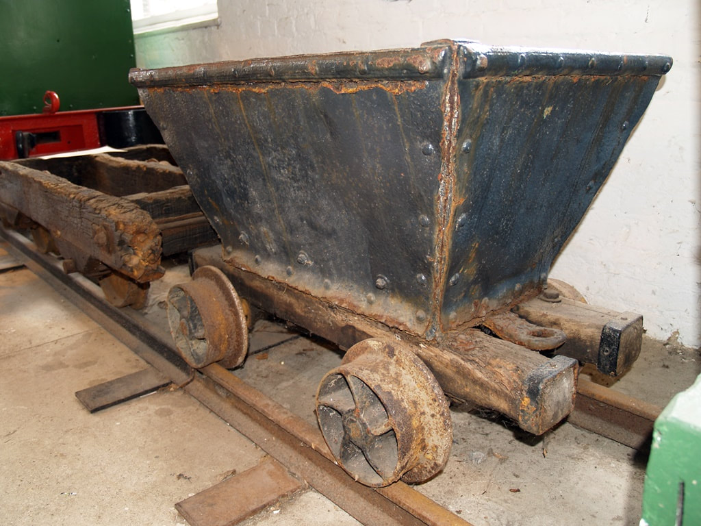
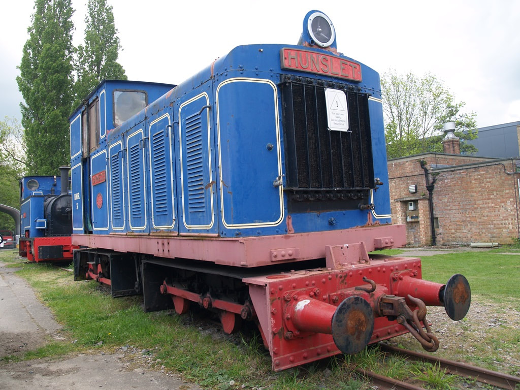
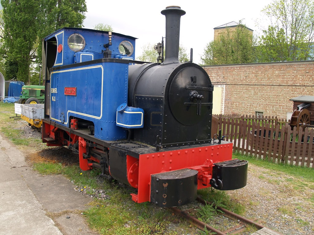
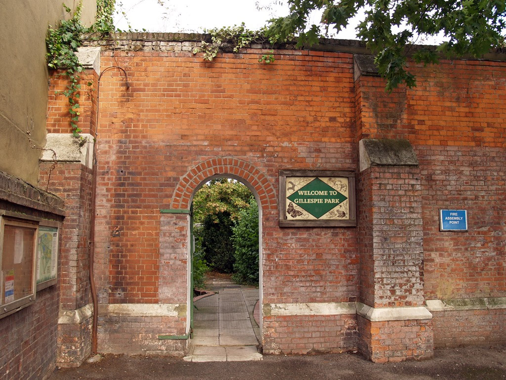
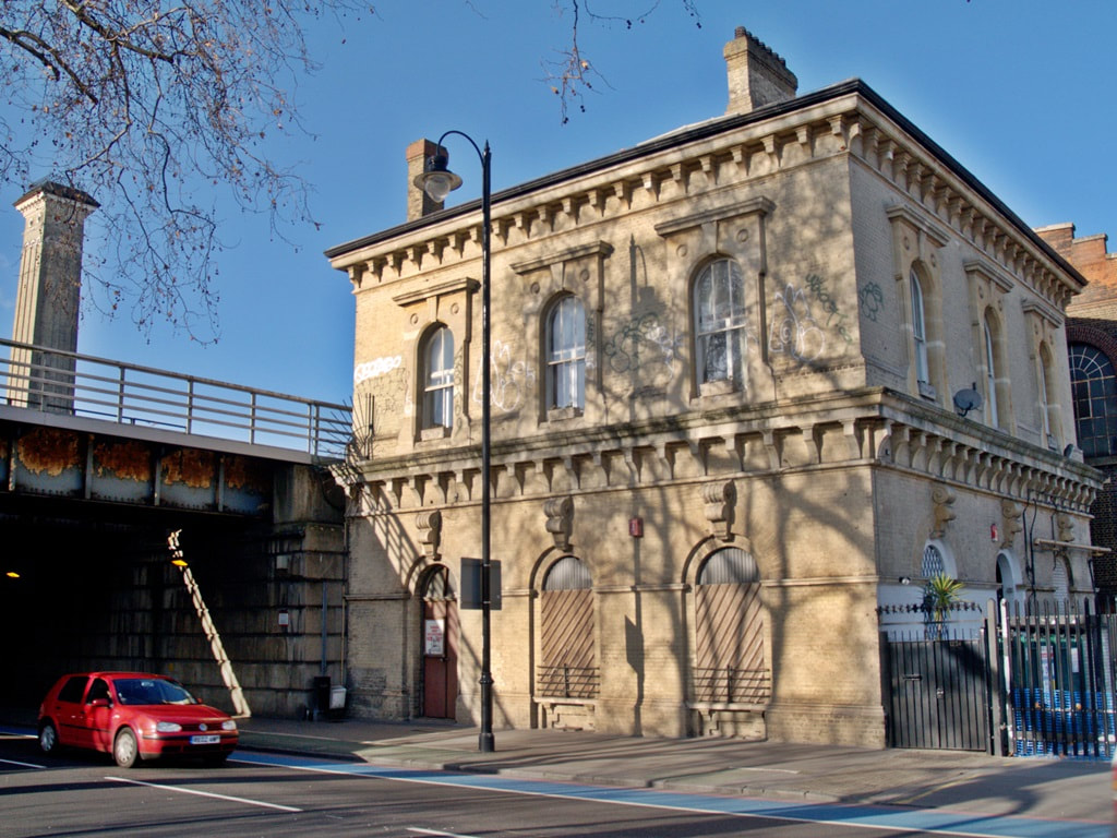
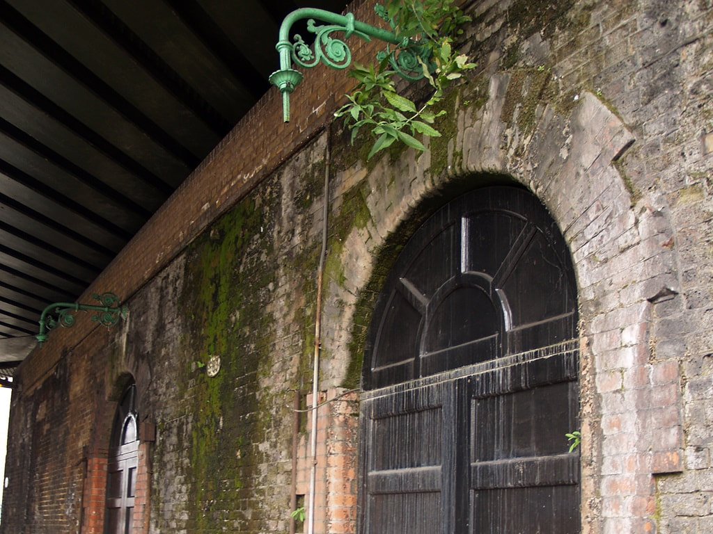
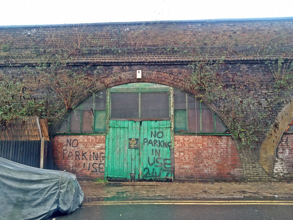
Below are some more railway photographs taken by myself over the years of running this website. I have hundreds more and